The Rectangular Fortress at Kadesh Barnea
David Ussishkin
Tel Aviv University
Israel Exploration Journal 45: 118-27. 1995 AD
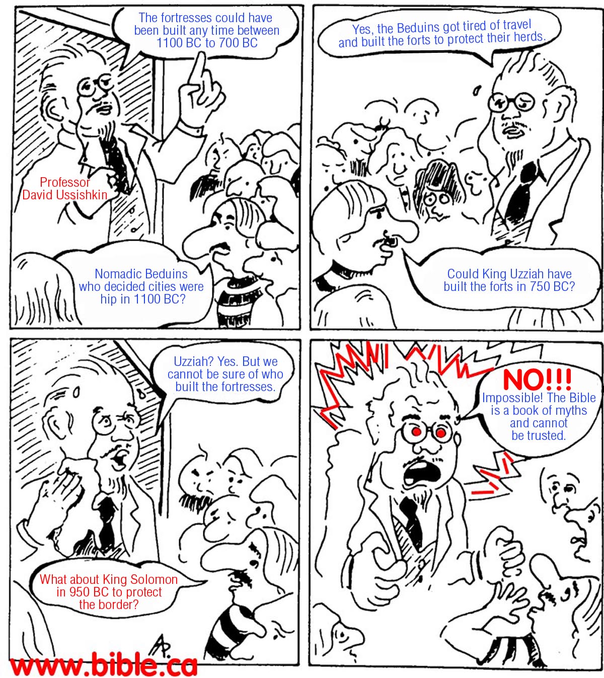
Website note: David Ussishkin is a modernist, Bible trashing archeologist: "I am afraid that evidence regarding the magnificent Solomonic capital was not discovered because it is nonexistent, not because it is still hidden in the ground." (Jerusalem in Bible And Archeology, David Ussishkin, Tel Aviv University, 2003, p.112). This means that he has a strong bias against the concept of Border Fortresses that Cohen proposes. However, Ussishkin does make some good comments regarding the procedures of archeology, although we question his interpretations. Ussishkin makes his comments based on a visit to the site in 1982 and in conjunction with other like minded liberal Bible trashers like Finkelstein. We include Ussishkin comments because he agrees with Dothan and Cohen, that the site was first inhabited about the time of David in 1000 BC. We have focused primarily on the earliest and oldest fortress at Qudeirat, since it is the only part of the site that has bearing on whether Qudeirat is the Kadesh Barnea of the Bible, which we reject. Ussishkin does acknowledge the earlier "oval fortress" but hardly discusses it at all except in passing. Most of his disagreement with Cohen is whether there were one or two rectangular fortresses built on top of the oval one. He concludes that there was one rectangular fortress that was used for a longer period of time built over the oval one, whereas Cohen sees two rectangular fortresses built and destroyed sequentially.
(The Rectangular Fortress at Kadesh Barnea, David Ussishkin, 1995 AD)
THE rectangular fortress at Kadesh-Barnea has raised considerable interest among scholars since C.L. Woolley and T.E. Lawrence surveyed it in 1914.1 M. Dothan carried out soundings in the fortress in 1956.2 Between 1976 and 1982 R. Cohen conducted large-scale excavations at the site on behalf of the Israel Department of Antiquities and Museums. Cohen published his main stratigraphic conclusions, but the factual data on which they are based were only partially published.3 Nevertheless, we possess sufficient data to question some of his central conclusions. The opinions presented below have, in fact, crystallised during a visit to the site in 1982 in the course of the last excavation season.
* This article, which offers notes on the excavation conclusions of R. Cohen, is a revised edition of a paper published in Hebrew in El 24 (1993), pp. 1-6. Dr. G. Barkay, Prof. I. Finkelstein, Prof. N. Na'aman and Ms. 0. Zimhoni read the manuscript and made very valuable comments. Figs. 1 and 5 are reproduced by courtesy of Prof. M. Dothan; Figs. 2-3 and 6 by courtesy of the Israel Antiquities Authority and Dr. R. Cohen; Fig. 4 was prepared by 0. Paran. I am indebted to all of them.
Stratigraphy
Following his soundings in 1956, Dothan reached four conclusions relevant to our study.
1 C.L. Woolley and T.E. Lawrence: The Wilderness of Zin (Archaeological Report), PEFA 3 (1914-1915), pp. 64-67.
2 M. Dothan: The Fortress at Kadesh-Barnea, IEJ 15 (1965), pp. 134-151.
3 R. Cohen: Notes and News: Kadesh-Barnea, IEJ 26 (1976), pp. 201-202; 28 (1978), p. 197; 30 (1980), pp. 235-236; 32 (1982), pp. 70-71, 266-267; idem, Did I Excavate Kadesh-Barnea? Biblical Archaeology Review 7/3 (1981), pp. 20-33; idem, Excavations at Kadesh-Barnea, 1976-1982, Qadmoniot 16 (61) (1983), pp. 2-14 (Hebrew); idem, Kadesh-barnea, A Fortress from the Time of the Judaean Kingdom, Israel Museum Catalogue No. 233, Jerusalem, 1983.
Fig. 1. Schematic reconstructed cross-section through the rectangular fortress (after Dothan).
Cohen presents an entirely different picture. We shall emphasize here solely the points relevant to us.
In my opinion, the stratigraphic data of the rectangular fortress should be interpreted along the lines of Dothan's conclusions rather than Cohen's, taking into account, of course, the newly excavated data. It seems that only a single rectangular fortress was built above the early oval one
; its wall was supported by a glacis, floor of the wall (i.e. the floor of the casemate rooms) was at the level of the tor of the glacis, and the structures inside the fortress were built at a lower level can be observed in the fortress of Arad, where, based on a plan prepared by Z. Herzog, the National Parks Authority restored such rooms on top of the solid wall on both sides of the gate.As aforementioned, the wall was surrounded by an earthen glacis whose top apparently reached the floor level of the casemate rooms. According to Dothan, `the earth bank surrounds the lower part of the wall, which it shields quite well. The glacis is made of terrepise mixed with sun-dried bricks, organic material and gravel. Its surface is formed of large cobblestones. It... had a gradient of 40°'6 (Fig. 5). Cohen distinguished two phases in the earthen glacis, but without presenting the data that led to this conclusion. Even if fill layers of different character could be distinguished here, it does not necessarily mean that two ramparts dating from different periods are represented.? Furthermore, even at the time of Cohen's 'upper fortress', the glacis rested against the solid wall rather than the casemate wall.
Fig. 5. The glacis, view from the north (after Dothan).
1 Cf., e.g., the deviation in orientation between the podium of the Judaean palace-fort at Tel Lachish and the superimposed residency of the Persian period, 0. Tufnell: Lachish III, The Iron Age, London, 1953, Pls. 118-119.
5 Cf., e.g., the wall surrounding the courtyard of the Level II city gate at Tel Lachish, which is built in this fashion, D. Ussishkin: Excavations at Tel Lachish 1978-1983, Second Preliminary Report, Tel Aviv 10 (1983), pp. 134-135 and Fig. 17.
6 Dothan (above, n. 2), p. 138.
7 Cf., e.g., the rampart surrounding the Iron Age enclosure at Tel Jezreel, which is made of two differently composed layers, D. Ussishkin and J. Woodhead: Excavations at Tel Jezreel 1990-1991, Preliminary Report, Tel Aviv 19 (1992), pp. 17-18, 51, Figs. 6, 15.
The solid wall of the 'middle fortress' was exposed on all four sides, but no gate to the fortress was discovered. If indeed it was a separate fortress, as assumed by Cohen, it must have been entered by means of a ladder, or by way of an earthen ramp reaching the top of the wall, as suggested by Mazar8 both solutions unknown in any Iron Age fortress or fortified town in Palestine. The absence of a gate to the 'middle fortress' apparently forms an additional argument supporting the conclusion that solely a single rectangular fortress was constructed here.
The builders of the rectangular fortress constructed an impressive water system, which, according to Cohen, served both the 'middle' and 'upper' fortresses. If indeed this was the case, we would have expected the water system to be destroyed temporarily or for good concurrently with the 'middle fortress'.
The fortress wall, except perhaps its bottom, was not supported by a constructional fill on the inner side. Hence, as noted by Dothan, the area inside the fortress was lower than that of the casemate rooms and the top of the glacis supporting the fortress wal1.9 Various structures were built inside the fortress, adjoining the fortress wall: clear proof that the inner face of the wall was mostly exposed after its construction. The fortress had been in use for a long period of time, and Cohen distinguished four layers of structures in it. Because the elevation of the area inside the fortress was lower, as explained above, the earlier three layers of structures were built at the level of the lower, solid part of the fortress wall and they adjoin the latter, while the upper, latest layer of structures was built at the level of the casemate rooms. In my opinion, this stratigraphic situation does not prove Cohen's claim that what we have is an earlier fortress with three layers of structures in it, superimposed by a later fortress with one layer of structures.'° In summary, it seems that the fortress was in use for a relatively long period of time, and the structures in it were rebuilt or changed three times, while the fortifications and the water system were continuously in use without interruption or change. We thus have here a good example of a monumental structure which lasted for a long time, while the adjoining domestic structures existed for a shorter period.11
8 A. Mazar: Archaeology of the Bible, 10,000-586 B.C.E., New York, 1990, pp. 444-446.
9 Dothan (above, n. 2).
10 A similar situation is known from other sites in which the settlement was surrounded by a particularly high wall and rampart, e.g. the MB II settlement at Tel Dan is at the level of the lower part of the fortifications, and the LB 'stelae temple' in Area
C at Tel Hazor is at the level of the lower part of the MB II rampart.
1 This phenomenon is familiar from other sites, e.g. Tel Megiddo, where it served as a guiding line in the stratigraphic studies of I. Dunayevsky and A. Kempinski: The Megiddo Temples, ZDPV 89 (1973), p. 162.
Fig. 6. Stone-built granaries and remains of structure outside the wall, at north-eastern side of fortress.
Cohen relates to the 'middle fortress' a few stone-built granaries and part of a structure located outside the fortress wall, between the north-east tower and the central tower on the northern side (Figs. 2, 6). According to the published reports this stratigraphic attribution is based on two data: the discovery of a layer of structures related to the early fortress beneath these remainsu and the fact that the granaries contained wheel-made pottery characteristic of the eighth-seventh centuries B.C.E.13 This stratigraphic conclusion cannot be accepted. This area is located outside the fortress wall and during the period of the rectangular fortress it was covered by the earthen glacis. Cohen indeed reports that the granaries were found beneath the fill layers of the glacis, but attributes these layers to the 'upper fortress'." In my opinion, the granaries and the adjacent structure predate the construction of the rectangular fortress. The area photograph (Fig. 6) strengthens the conclusion that these are structural remains damaged by the construction of the wall. It thus seems that two structural layers antedating the construction of the rectangular fortress existed in this area. Regarding the eighth-seventh-century pottery, it is difficult to weigh the problem on the basis of the partial data available; the pottery may have been dumped here when the earthen glacis was laid, a possibility with significant chronological implications.
12 For a general plan of the 'early fortress' level, see Cohen (above, n. 3, Qadmoniot), p. 4: idem (above, n. 3, Catalogue), p. IX. In another plan these remains are labelled 'Structure B'; see R. Cohen: The Settlement of the Central Negev (Ph.D. diss., The Hebrew Universit) of Jerusalem), Jerusalem, 1986, Pl. 129.
13 R. Cohen: Kadesh-Barnea 1980, .fladashot Arkheologiyot 77 (1981), p. 45 (Hebrew).
14 Cohen (above, n. 13).
The rectangular fortress in its final stage was violently destroyed, as noted both by Dothan and Cohen. Burnt layers and assemblages of complete pottery vessels were found sealed beneath the destruction debris. On the other hand, there are no clear indications for the 'destruction' of the 'middle fortress', as assumed by Cohen. Remains of ashes here and there may indicate the buildings' domestic use, and not necessarily a violent destruction. Also missing are large assemblages of complete pottery vessels so characteristic of destruction layers during this period.
We can sum up the stratigraphic discussion of the rectangular fortress's fortifications as follows: The fortress was surrounded by a stone wall which included eight projecting towers, at the corners and at the centre of each side. The lower part of the wall and of the towers was solid, while casemate rooms were built in the upper part. An earthen glacis, sloping at c. 40° and faced with cobblestones, was laid against the wall's outer face. The upper edge of the glacis reached the floor level of the rooms built along the upper part of the wall. The bottom of the glacis was supported by a retaining wall. A deep moat extended along the retaining wall on three sides, with the exception of the southern side, which bordered on the wadi slope. The entrance to the fortress was through one of the wall rooms. A water reservoir, which could be filled from outside with a conduit, was built inside the fortress. A constructional fill was not laid inside the fortress, hence it was at the same level as the lower part of the wall. The structures inside the fortress were thus built at the level of the lower part of the wal1.15
Methodology
Cohen's interpretation of the stratigraphic data of the rectangular fortress largely results from the methods employed in the site's excavation.
Firstly, the excavation program should have been planned in advance to separate the parts to be excavated from those to remain purposefully unexcavated. Such a strategy would have been particularly easy to adopt in Kadesh-Barnea, where the outlines of the main structure were known prior to the excavation. This separation, had it been adopted, would have enabled future excavators to conduct orderly stratigraphic examinations.
Secondly, the excavation should have been planned in such a way as to create cardinal sections perpendicular to the wall of the rectangular fortress. In fact, such sections could have been created on all four sides of the fortress. Such cardinal sections should have included the remains from the centre of the fortress to the exterior edge of the moat.16 This would have elucidated the stratigraphic situation, which we are presently attempting to restore with the aid of theoretical sections (Figs. 1, 4). The absence of proper sections laid perpendicular to the wall apparently explains why the earthen glacis surrounding the wall which had been observed by Dothan in 1956 was fully understood by Cohen only in 1981, during the sixth excavation season."
Thirdly, bulldozers should not have been used to expose the outer face of the wall. This was done in order to locate the assumed gate of the 'middle fortress'.18 As a result, however, the earthen glacis, an integral part of the fortifications, was practically destroyed, the foundations of the wall were exposed, and almost certainly important data pertaining to the structure of the glacis were lost. In this connection we should also mention the conservation aspect: once the glacis has been removed the face of the wall is exposed, and it is to be expected that this wall intended by its builders to be covered will deteriorate in the near future.
Historical Aspects
Dothan and Cohen assumed that Kadesh-Barnea was included in the territory of the Judaean kingdom, hence the rectangular fortress was built by the kings of Judah. Cohen assumed that the 'middle fortress' was constructed in the eighth century B.C.E., perhaps in the course of Uzziah's rule, and destroyed in the middle of the seventh century, perhaps during the reign of Manasseh. The 'upper fortress' was built, in his opinion, in the seventh century B.C.E. during Josiah's reign and destroyed in 586 B.C.E. by the Babylonian army.
15 Many elements in the fortifications of the rectangular fortress at Kadesh-Barnea can be compared to other Iron Age fortifications in Palestine. Here I shall mention only the Iron Age enclosure at Tel Jezreel, apparently constructed by the Omride dynasty in the ninth century B.C.E. The Tel Jezreel enclosure is rectangular as well, surrounded by a casemate wall with projecting towers at the corners. A massive rampart is laid against the exterior of the wall and towers. A retaining wall supporting the outer edge of the rampart and a deep rock-cut moat form the external elements of the fortifications. The rampart and the moat surround the site along three sides, but are absent along the north side, where the enclosure borders on a steep slope. Ussishkin and Woodhead (above, n. 7), p. 51, Figs. 3, 6.
16 On the importance of sections laid perpendicular to a structure as a main tool for interpretation of the data, see M. Wheeler: Archaeology from the Earth, London, 1954, pp. 91-105; K.M. Kenyon: Beginning in Archaeology (2nd rev. ed.), London, 1971, pp. 87-91.
17 R. Cohen: Kadesh-Barnea 1981, Hadashot Arkheologiyot 77 (1981), p. 47: 'This season it became clear that the "upper fortress" and possibly also the "middle fortress" were surrounded by a rampart leaning against a retaining wall' (translated from Hebrew); see also idem, Qadesh Barne`a 1981/1982, Excavations and Surveys in Israel 1 (1982), p. 95.
18 Oral communication at the time of the excavation by R. Cohen.
The starting point for an evaluation of the historical ramifications is the conclusion that only a single rectangular fortress was erected here. This fortress was in use for a considerable period of time, as it contains four layers of structures, and was violently destroyed. Although it is difficult to discuss the fortress's chronology before the full publication of the pottery, the assemblage sealed beneath the destruction debris contained vessels characteristic of the final days of the Judaean kingdom. It thus seems that the fortress was built in the eighth, or the beginning of the seventh century, and destroyed in the first part of the sixth century B.C.E.
N. Na'aman has recently argued that the territory of the Judaean kingdom during Josiah's reign was relatively small and certainly had not included the region of Kadesh-Barnea.1 9 On the basis of this view, it seems that the rectangular fortress of Kadesh-Barnea was neither built by the kings of Judah, nor served as a Judaean fortress. There are no data indicating who built and held the fortress for a long period. I shall mention here Na'aman's 'working hypothesis' that the Assyrians initiated the construction of the fortress, while the Egyptians held it at a later stage. According to this suggestion, the garrison stationed at the fortress included soldiers from vassal states, including soldiers from Judah.
Appendix: Kadesh-Barnea and Kuntillet 'Ajrud
The enclosure of Kuntillet 'Ajrud, excavated by Z. Meshe1,20 is an unusual site, whose nature and function are far from clear. Although it is located in southern Sinai, the finds from the enclosure indicate strong cultural connections with the kingdoms of Israel and Judah. The route and means of these connections are of great importance.
Kuntillet 'Ajrud is located c. 50 km. south-west of Kadesh-Barnea; hence the assumption that Kadesh-Barnea served as a central station along the route from Israel and Judah to Kuntillet 'Ajrud. According to Meshel, Kadesh-Barnea was a station along Darb el-Ghaza, the road to Eilat which passed in the vicinity of Kuntillet 'Ajrud.
21Cohen's conclusion that the excavations at Kadesh-Barnea attest to settlement continuity from the 10th to the 5-4th centuries B.C.E. forms the background to the above view. According to Cohen, it included three successive governmental fortresses built by the kings of Judah. If that is so, Kadesh-Barnea must have been a central station on the long route from Israel and Judah to Kuntillet 'Ajrud
.19 N. Na'aman: The Kingdom of Judah under Josiah, Tel Aviv 18 (1991), pp. 48-49.
20 See, e.g., Z. Meshel: Kuntillet 'Ajrud, A Religious Centre from the Time of the Judaean Monarchy on the Border of Sinai, Israel Museum Catalogue No. 175, Jerusalem, 1978.
21 See, e.g., Z. Meshel: The History of `Darb el-Ghaza' The Ancient Road to Eilat and Southern Sinai, El 15 (1981), pp. 361-362 (Hebrew).
The opposite, however, seems to be true. Scholars agree that the enclosure of Kuntillet 'Ajrud is a single period site dating from the end of the ninth or the beginning of the eighth century B.C.E.
During this period the site of Kadesh-Barnea was abandoned (E. Ayalon, who studied the pottery assemblage of Kuntillet `Ajrud, emphasized the absence there of the pottery assemblages characterising Kadesh-Barnea22). Hence Kadesh-Barnea and its fortress were not a factor in developing connections between Israel and Judah and Kuntillet 'Ajrud beyond the fact that Kadesh-Barnea formed an oasis along the desert route. This strengthens the conclusion that Kuntillet 'Ajrud was a unique place, and is a factor that should be taken into account when the character and function of the site are being evaluated.22 E. Ayalon: The Iron Age II Pottery Assemblage from klurvat Teiman (Kuntillet `Ajrud)(M.A. diss., Tel Aviv University), Tel Aviv, 1985, p. 102.
By Steve Rudd: Contact the author for comments, input or corrections.
