The Temple in Jerusalem was not located over the Dome of the Rock:
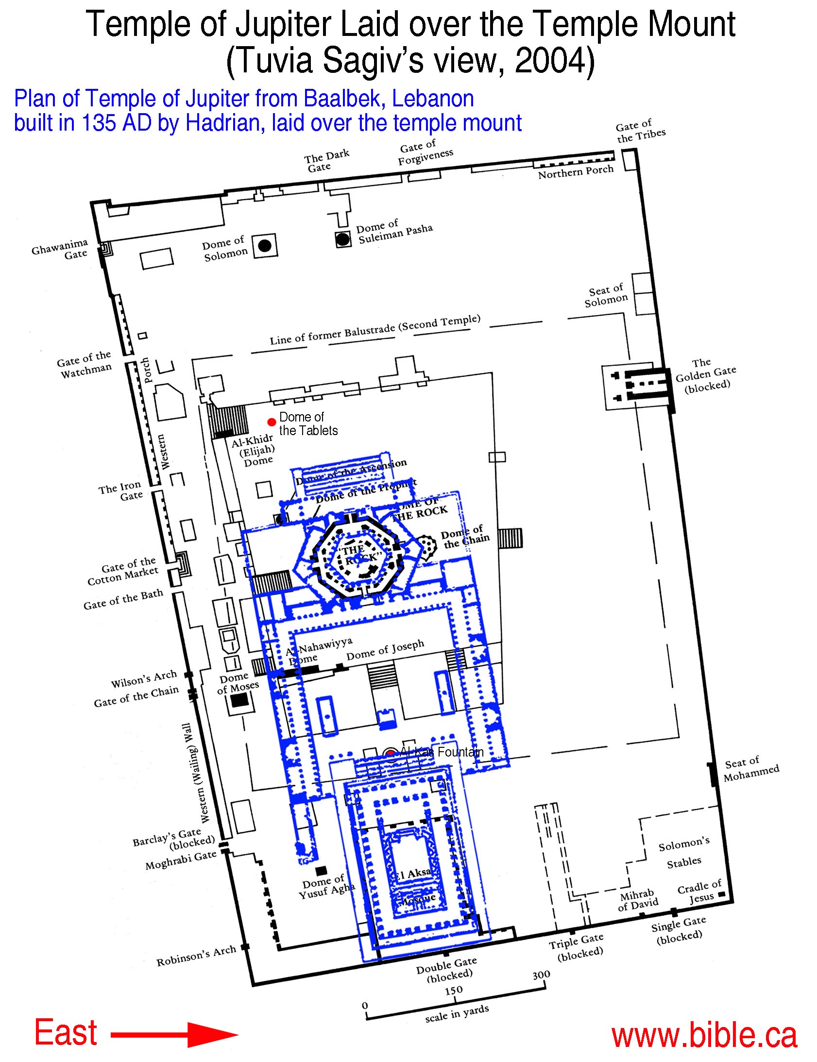
Solomon built the temple on the threshing floor David bought. The Dome of the rock is the highest point of the temple mount. Threshing floors were never built on hills, but in curved valleys, like directly under the Al Kas Fountain. Under the dome of the Rock, was where the Fortress of Antonia stood. In 135 AD, Hadrian filled in about 50 feet of earth over top of where the temple stood and enlarged the temple mount and built a temple of Jupiter where we see the Dome of the rock today. In 325 AD Contanstine tore down the Temple of Jupiter and assumed Hadrian built the temple of Jupiter on top of the spot where the temple of Solomon once stood. Constantine built an octagon church on the site. In 700 AD the Muslims found the foundations of Constanine's octagon church and built the dome of the Rock we see today.
Introduction:
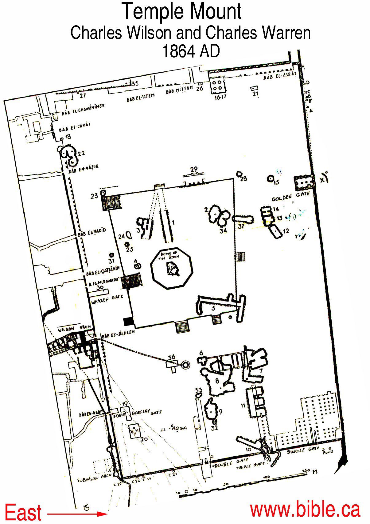
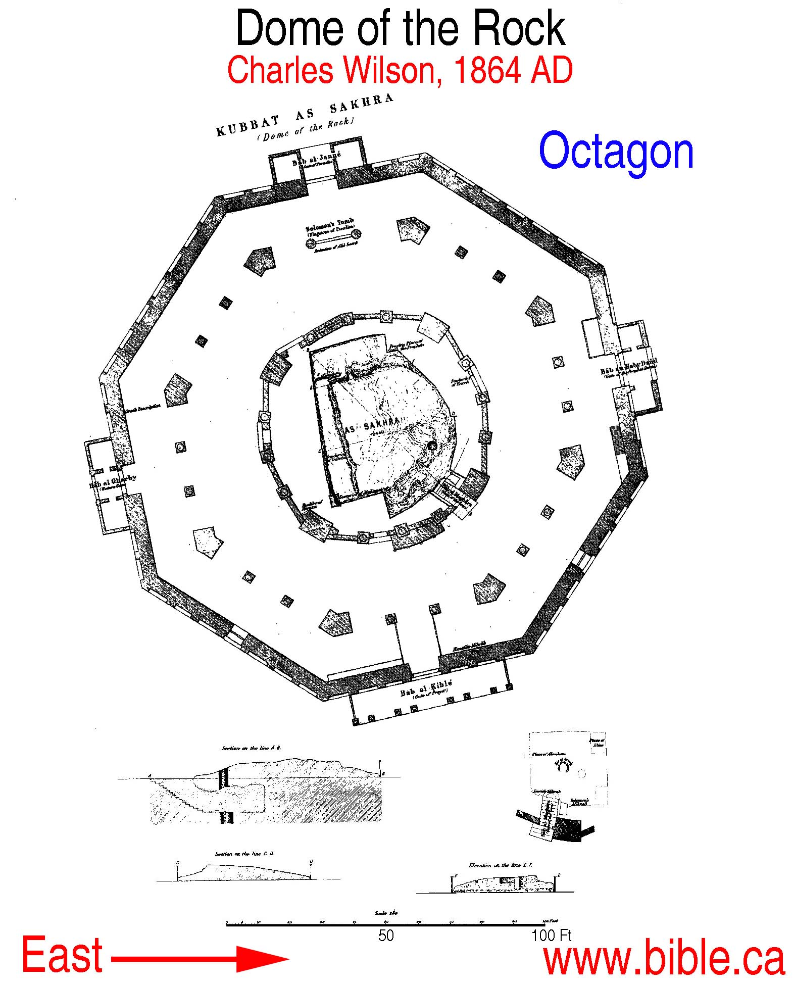
A. Charles Wilson's work in 1864 AD:
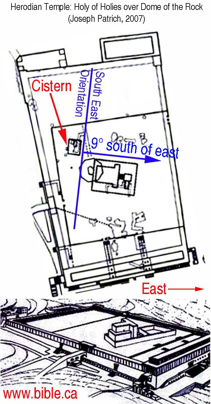
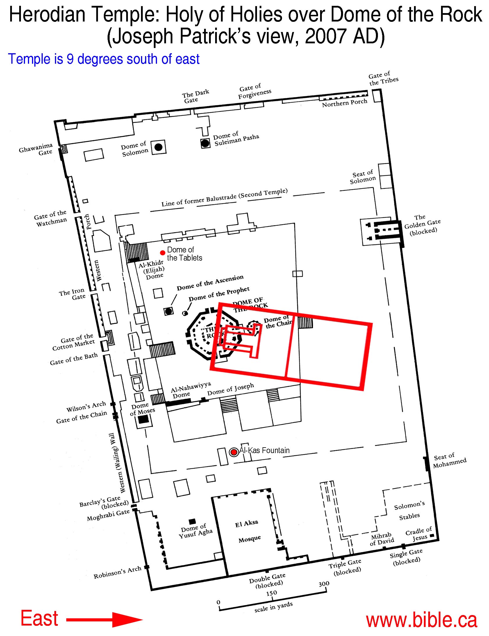
B. Joseph Patrich's theory:
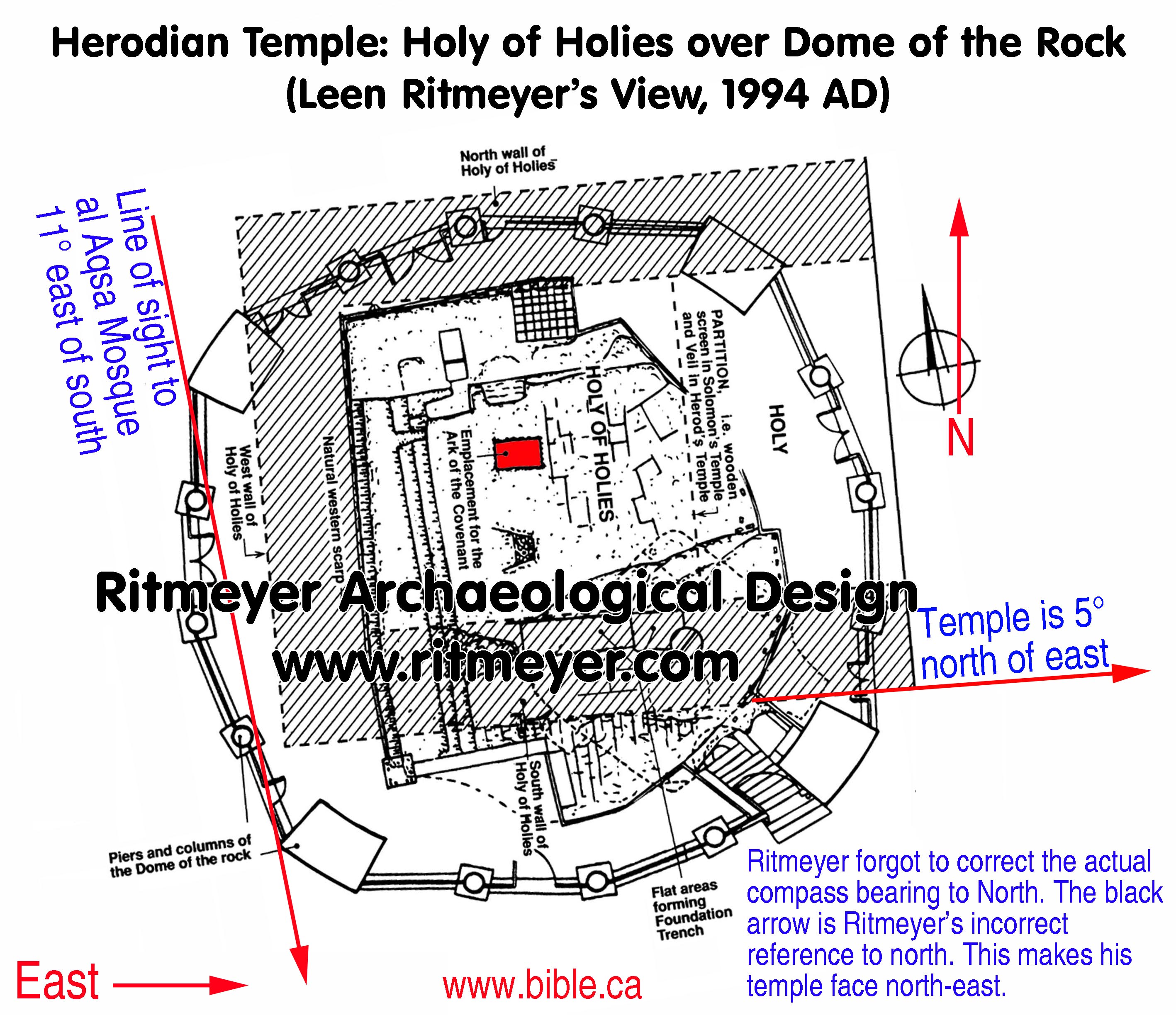
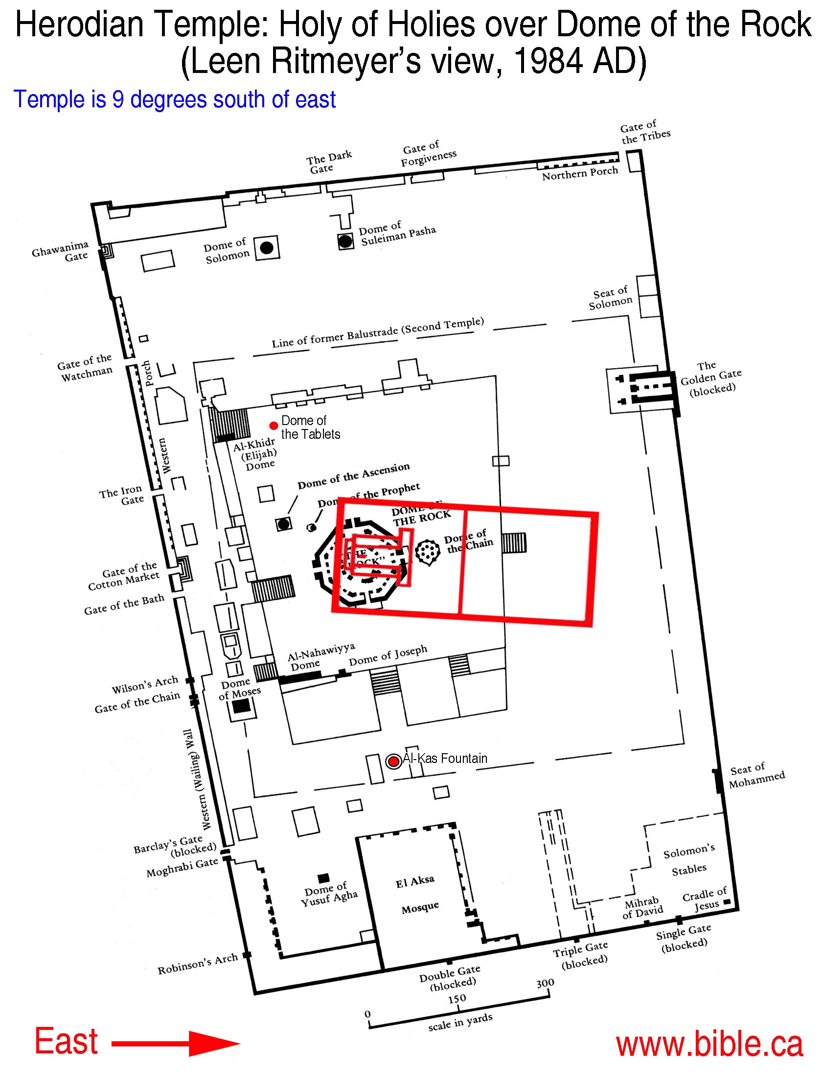
C. Leen Ritmeyer's 1984 AD theory: "that rectangular carved depression"
|
Leen Ritmeyer's view explained: (Excerpt from: Randall Price, The Stones Cry Out) Has Archaeology Found the Place of the Ark? Ever since the Babylonian captivity 2,500 years ago, the exact location of the Ark has been unknown. Although rumors persist that the Ark of the Covenant has been located here or there, no archaeological evidence has been produced to substantiate any of the claims. However, we may now be able to figure out where the Ark once rested within the ancient Holy of Holies. If, as we saw in the previous chapter, it is possible to deduce the location of the Temple building and its Holy of Holies, then it might be possible to locate where the Ark once was placed within this structure. According to ancient sources such as Josephus and the Mishnah tractate Middot, the Ark had rested on a bedrock platform. In Jewish tradition, this platform was called `Even Ha-Shetiyah ("the Foundation Stone"), and in Arabic, es-Sakhra ("the Rock"). According to research done by Leen Ritmeyer, former chief architect of the Temple Mount excavations and today director of Ritmeyer Archaeological Design in England, the huge rock within the present-day Islamic Dome of the Rock has to be the bedrock platform within the Holy of Holies. Ritmeyer explains how he came to this determination: "It took me 20 years to figure it out. I was convinced that the Temple must have stood here somewhere. I started to look at the measurements of the Rock and the interior measurements of the Temple. We know that the interior measurements of the Temple were 20 cubits wide. The Holy [Place] was 40 cubits long and the Holy of Holies was 20 by 20 cubits. If you use the measurements of the 500 cubits measurements from the Mishnah it would measure 10.5 meters [34 feet] thereabouts. Comparing that with the size of the Rock, the Rock is larger than the Holy of Holies. Yet, the Mishnah [Yoma 5:2] says that this stone is called `Even Ha-Shetiyah, "the Foundation Stone." Why would they call it the Foundation Stone? Because if the Holy of Holies was smaller than the Rock, then the Rock would have served as a foundation for at least one of the Tem-ples. With that information in mind, I started looking closer at the Rock for a foundation." (Transcript from annual meeting of the Near Eastern Archeological society, Nov 20, 1996, Jacksonville, Miss.) Ritmeyer's look at the Rock began first by eliminating the signs of Crusader quarrying on the Rock, which in A.D. 1099 had been captured from the Muslims and converted into a Christian church called Templum Domini ("the Temple of the Lord"). He attributed cuts in the Rock on the north, south, and west sides to their actions. The Crusaders thought that the rock disfigured the Temple of the Lord and shaped it into what they believed was a more acceptable size, then built an altar on top of the Rock. In 1187, when the caliph Saladin recaptured the Dome of the Rock for the Muslims, they found it covered with marble slabs. Upon removing the slabs they found that the Rock had been mutilated. This mutilation included the enlarging of a cave and some deep tunnels dug beneath the Rock, which may indicate that the Crusaders were trying to locate the suspected hiding place of the Ark. The natural cave below the Rock was identified by them as the Holy of Holies, where they commemorated the angel's visit to Zacharias. They enlarged this cave in order to use it as a sanctuary, and because they burned candles and incense in the cave, it was necessary for them to cut a vertical shaft for ventilation (this formed the present hole in the Rock). Thus, before the Crusaders disfigured the Rock, the upper level would have been larger and flatter . Ritmeyer then measured the flat areas in the southern part of the Rock, which he identified as foundation trenches. Their combined dimensions agreed perfectly with the known thickness of the walls of the Second Temple (6 cubits or 10 feet and 4 inches). This foundation trench revealed the location of the southern wall of the Holy of Holies. The back wall would then have rested against the unchangeable natural rockscarp to the west. The northern wall would have been adjacent to the northern end of the Rock itself. This placement of the walls also agreed with Ritmeyer's earlier calculations about the placement of the original Temple platform. He found that the direction of the western scarp was virtually identical to that of the steps, which he had identified previously, and the eastern wall of the Temple Mount. So, the First and Second Temples would have had the same orientation -the longitudinal axis of the Temple at right angles with the eastern wall. This axis is also aligned with the highest point on the Mount of Olives, where the sacrifice of the red heifer (necessary for ritual purification-Numbers 19) took place. This became a further confirmation to Ritmeyer of his location of the Temple.The Site of the Ark Discovered Having identified these structures, Ritmeyer began looking for additional clues to position the Holy of Holies. He tells the story of how this identification was first realized: "Once I began to research this problem in the Spring of 1994, the secrets of the Sakhra revealed themselves to me in such rapid succession that it was sometimes breathtaking. While flying to Israel, 30,000 feet high in the air, I got my first glimpse of the most spectacular of all the discoveries, namely that of the former location of the Ark of the Covenant! Averting my gaze from the in-flight video, I took out a large photograph of the Sakhra from my briefcase and tried to trace again those flat areas, which, of course, were familiar to me as foundation trenches.... I sketched over the flat areas on the photograph of the Sakhra the line of the southern wall of the Holy of Holies....I drew the western edge of the Rock and the northern wall at the northern end of the exposed rock.... I also drew a dotted line where the veil, which separated the Holy of Holies from the Holy [Place], would have hung. I did not expect to find any remains as no wall had existed there. I then suddenly noticed in the middle of this square a dark rectangle! What could it be? The first thing that came to mind was, of course, the [place of the] Ark of the Covenant, which once stood in the centre of the Holy of Holies in Solomon's Temple. But that surely could not be true, I thought.... [However,] according to my plan, it falls exactly in the centre of the Holy of Holies. The dimensions of this level basin agree with those of the Ark of the Covenant, which were 1.5 x 2.5 cubits (2'7" x 4'4" or 79 cm. x 131 cm.), with the longitudinal axis coinciding with that of the Temple. Its location is rather unique, as it could only have been the place where the Ark of the Covenant once stood. It is clear that without such a flat area the Ark would have wobbled about in an undignified manner, which would not conceivably have been allowed." (Leen Ritmeyer, The temple and the Rock, 1996, p24, 24, 41) According to Ritmeyer, then, this depression in the Rock served as a base to secure the Ark within the Holy of Holies. It could not have been created by the Crusaders because they covered the Rock with slabs to hide it, and would have placed a statue (in such a base) in the middle of the Rock, not at the north of the Rock (where the depression would have been at that time). (cf. Leen Ritmeyer, The Ark of the Covenant, where it stood in Solomon's temple, Biblical Archeological Review Jan/Feb 1996; Leen Ritmeyer, Locating the Original Temple Mount, Biblical Archeological Review Mar/Apr 1992) We can summarize Ritmeyer's research in the accompanying diagram, which he drew. Litmeyer was invited to comment on his error in the compass bearing on his drawing, but never replied.
It depicts a north-south section through the Herodian Temple Mount and its Courts in relation to the present-day Dome of the Rock. One can see the original bedrock designated "Sakhra," which was the highest point on Mount Moriah-where Abraham had offered Isaac and the Angel of the Lord had stood in the days of King David. Inside is the natural cave from Solomon's time; the western scarp of which is where the western wall would have been built. The floor of the Holy of Holies has an indented area where the Ark of the Covenant would have been placed in Solomon's Temple. While it's impossible to archaeologically investigate the Rock to confirm Ritmeyer's conclusions, if he is correct, we now have for the first time identified the site of the Holy of Holies and of the former location of the Ark of the Covenant itself. In this case, the stone of stones has shouted with evidence that the Ark existed! (Randall Price, The Stones Cry Out, 1997, p211-217) |
Conclusion:
By Steve Rudd: Contact the author for comments, input or corrections.