Chronological History of the search for Kadesh
Kadesh is located at ancient El Beidha in
Petra
2000 BC - 2020 AD
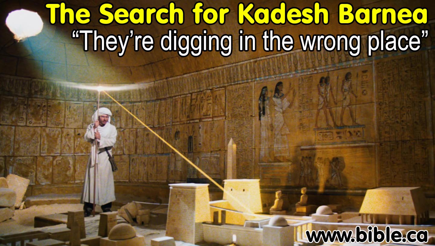
Indiana: "Balloq's medallion only had
writing on one side? You sure about that?"
Sallah: "Positive!"
Indiana: "Balloq's staff is too long. Indiana."
Both: "They're digging in the wrong place!"
"For 100 years they have been digging for Kadesh in the wrong place"
Chronological history of the search for Kadesh Barnea:
Introduction:
1. The search for Kadesh Barnea has been misguided. This reminds us of that classic moment in the Indiana Jones movie, "Raiders of the Lost Ark" where the Germans were "digging in the wrong place" for the Ark because the did not have all the information. For the last 100 years, archeologists were "digging in the wrong place" to find Kadesh. Kadesh, in fact, is not located anywhere near the place almost all Bible maps say it is (ei. Qudeirat) but 100 km east at or near Petra.
a. The Hebrews left Egypt in 1446 BC and spent 38 years at Kadesh and then entered the promised land in 1406 BC.
b. Many people are unaware that historically, Kadesh was thought to be at Petra from 1446 BC - 1831AD.
2. Our proposed Exodus Route:
a. The Scriptures as a whole teach, along with geographic analysis, that the Hebrews crossed the Red Sea on the Gulf of Aqaba, specifically at the Straits of Tiran.
b. The scriptures teach that Mount Sinai is somewhere in north Saudi Arabia. (History leads us to suggest Mt. Lawz as the most likely place.)
c. The scriptures teach that Kadesh Barnea is Transjordan, somewhere south of the Dead Sea in modern Jordan. (History and archeology leads us to suggest Kadesh is located in Petra area, just 5 km north of Petra at Beidha.)
3. For 3800 years Kadesh Barnea was located at Petra. (2000 BC - 1831AD)
2000 BC: Abraham at En-mishpat: En-mishpat means "Spring of Judgement" that was renamed Kadesh by the Hebrews during the Exodus. Genesis 14:7 says: "Then they turned back and came to En-mishpat (that is, Kadesh), and conquered all the country of the Amalekites, and also the Amorites, who lived in Hazazon-tamar."
1444 - 1406 BC: Kadesh-Barnea Hebrews spent 38 years at Kadesh Barnea with Moses and Joshua.
350 BC - 106 AD: Nabateans at Petra The Nabateans enlarged and enhanced the tomb city of the Hebrews. Everything we see today in Petra was the work of the Nabateans. Like Pharaoh in Egypt, the Nabateans removed all traces of the Hebrews in the multi coloured sandstone. Petra is a second use of the Hebrew Kadesh Barnea.
106 AD: Roman Petra: Arabia. The Romans annexed Petra and renamed it Arabia. Petra became the capital city of Roman Arabia.
100 AD - 400AD: Petra Josephus, Eusebius and Jerome all stated that Kadesh was at Petra.
325 AD: Queen Helena (Constantine's mother) dreams that Mt. Sinai is located at Mt. Musa in the Modern Sinai.
1821-1881 AD: Arabah Valley. Archeologists started looking for Kadesh on the western side of the Arabah valley where ever they found a natural spring. Two such choices were Ein El Weibeh and Ein Hasb. Of course neither of these could be Kadesh because the western edge of the Arabah valley was the Territory of Judah.
1881-1916 AD: Ein el Qedeis. The search moved to the Quseima district and Ein El Qedeis became the choice the world accepted for Kadesh between 1881 and 1916 AD mainly because of the deceptive account of Trumbull where he described how Qedeis was as green, lush and buzzing with wildlife as "New England".
1916 -2004 AD: Ein el Qudeirat. Wooley and Lawrence arrived and quickly rejected Qedeis as Kadesh and then excavated Ein el Qudeirat about 6 km north of Qedeis. When they learned that Ein el Qudeirat is the largest natural water supply in the entire Sinai, they immediately declared they had found Kadesh Barnea. As they excavated the site, they were unaware that they were actually digging up a fortress built by Solomon in 950 BC to protect Judah's southern border, they falsely assumed the building was present at the time of Moses.
2004 AD - present: A restoration, by the author, of the true exodus route that the first century Christians believed, including the location of Mt. Sinai (Jebel Al-Lawz), the crossing point of the Red Sea (Straits of Tiran) and the location of Kadesh Barnea at Petra. This of course is not really a discovery, but more of a restoration in harmony with the Bible and the most ancient history sources combined with modern archeology.
4. Factors that mislead the search for Kadesh:
a. Misunderstanding the expression, "the border goes up south of Kadesh" in drawing the southern border of Judah. See detailed examination on the correct way to draw Judah's southern border.
b. Looking for large natural water supplies. Kadesh has a spring but with the water table so much lower today in Israel it is likely dried up. At Kadesh, Israel complained there was not enough water and Moses had to strike the rock and supply the water by miracle. Woolley and Lawrence stated that they were looking for a site with a large enough natural water supply to sustain Israel: "If this second view be accepted, then it is definitely our opinion that only in the Kossaima district are to be found enough water and green stuffs to maintain so large a tribe for so long" (The Wilderness of Zin, Woolley and Lawrence, 1914-1915 AD) This notion is entirely misguided since the water supply at Kadesh was miraculous.
c. Henry Clay Trumbull's deceptive description of Ein El Qedeis in 1881 AD, had the same effect in archeology as the Piltdown man fraud had in evolution. For 35 years the world was misled by Trumbull's fraud until Woolley and Lawrence published the The Wilderness of Zin in 1916 AD. In the same way Arthur Woodward misled the world in 1912 AD with his Piltdown man which convinced the world for over 40 years that evolution was true when in fact the scientific case for young earth creation is powerful and convincing.
Detailed history of the search for Kadesh Barnea:
2000 - 1446 BC: Abraham at En-mishpat:
- En-mishpat means "Spring of Judgement". It was renamed Kadesh by the Hebrews during the Exodus.
- Genesis 14:7 says: "Then they turned back and came to En-mishpat (that is, Kadesh), and conquered all the country of the Amalekites, and also the Amorites, who lived in Hazazon-tamar."
- Both Eusebius and Jerome state that the Spring of Judgement of Gen 14:7 was located at Petra.
- Jerome said: "Gen 14:7: And they returned and came to the fountain of judgement, that is, to Cades. Because Cades was so named later on, it is specificied by way of anticipation; and it refers to a place near Petra, which is called 'The Fountain of Judgement', because God judged the people there" (Saint Jerome's Hebrew Questions on Genesis, translated by C. T. R. Hayward, p 46, Gen 14:7, 1995 AD)
|
|
1444 - 1406 BC: Hebrews 38 years at Petra |
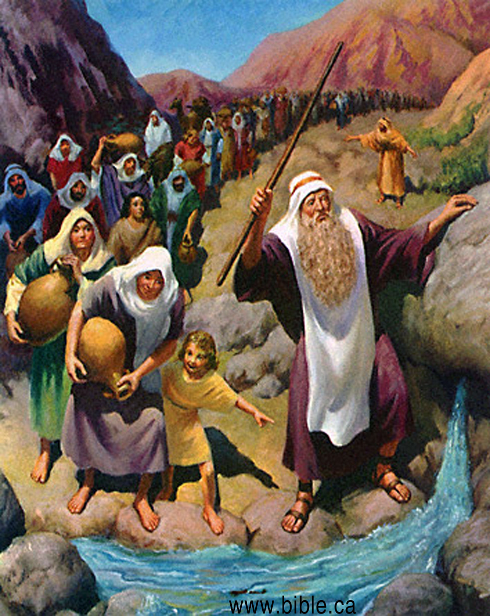
- Hebrews spent 38 years at Kadesh Barnea with Moses and Joshua.
- Here Miriam and Aaron and 2.5 million Hebrews died. Kadesh-Barnea was a sacred "tomb city" associated with death to the Hebrews. Kadesh was at what became Petra. Kadesh means "sanctuary". Even in Hebrew culture today, the "Burial Society" is called the "Chevra Kaddisha" (Chevra = society; Kaddisha = holy). Therefore Kadesh = Kaddisha = Burial. Jews have always place extreme importance on burial. Kadesh derives its name as the holy place they buried their dead for 38 years.
- There are archeological traces of the Hebrews at Petra that predate the Nabateans. While the time scale of these archeologists is off by a factor of 5x, (2000 BC not 10,000 BC) the facts of archeology show a Hebrew presence.
- "Even before the historical period, however, the Petra region was inhabited by Stone Age people who exploited its natural vegetation and wildlife. Diana Kirkbride's pioneering work at Beidha has revealed the presence of an important Neolithic village from the 7th millennium BC, along with traces of even earlier Natufian camps from the 9th and 10th millennia BC. Recent surveys and excavations in the Petra area by a West German team from Tubingen University, headed by Hans Peter Uerpmann and Hans Georg Gebel, have discovered a handful of new settlements, seasonally occupied campsites and rock shelters from the same closing millennia of the Stone Age." (Petra: a guide to the capital of the Nabataeans, Rami G. Khouri, 1986, p11-27, p41-44)
|
|
350 BC - 106 AD: Nabateans at Petra |
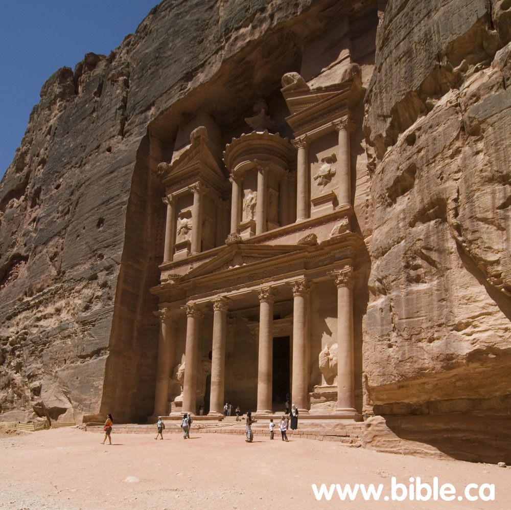
- The Nabateans enlarged and enhanced the tomb city of the Hebrews. Everything we see today in Petra was the work of the Nabateans. Like Pharaoh in Egypt, the Nabateans removed all traces of the Hebrews in the multi coloured sandstone. Petra is a second use of the Hebrew Kadesh Barnea.
- The treasury and other structures carved out of the sandstone are all the work of the Nabateans. It is entirely possible that when the Nabateans arrived, there was a cave carved out where the treasury is today, but the Nabateans used this as a beginning point for the "treasury" we see today.
106 AD: Roman Petra: Arabia.
- The Romans annexed Petra and renamed it Arabia.
- Petra became the capital city of Roman Arabia.
- Josephus and Eusebius all refer to Petra at Arabia. The Modern Sinai peninsula was never called Arabah. Yet Paul said Mt. Sinai was located in the land of Arabah (Gal 4:25) proving Mt. Sinai could not be located where most people say it is today.
- Philo of Alexandria (50 AD) Philo describes the route to the Red Sea crossing as "a long and desolate journey through the wilderness, destitute of any beaten road, at last arrived at the sea which is called the Red Sea" an "oblique path", "off the main road", a "pathless track" and a "rough and untrodden wilderness". Two passages in the Bible describe this "wilderness before the crossing point": Judges 11:16; Exodus 13:18. Philo describes it in detail. This not only rules out the Bitter Lakes and a North Suez crossing point, it also proves Mt. Sinai cannot be in the Sinai Peninsula. Philo's use of the terms Arab and Arabia, were restricted to the land east of the Gulf of Aqaba where Jethro and the Ishmaelite lived, and he never says the Sinai Peninsula is Arabia.
100 AD - 400AD: Petra
1. Josephus stated that Kadesh was at Petra.
2. Eusebius stated that Kadesh was at Petra: Kadesh Barnea (or Cades Barnea):
a. "Kadea Barne. The desert which extends to (the city of) Petra a city of Arabia. There Mariam went up and died, and there the doubting Moses struck the rock to give water to the thirsty people. The tomb of Mariam herself is pointed out there even now. There also Chodollagomor beat the chiefs of the Amalakites." (Eusebius, Onomasticon, round brackets are Eusebius') Footnote #: 580. (Eusebius, Onomasticon)
b. Kadēa Barnē. Numbers 32:8; K. 112:8; L. 270:4. Textual variant city of Palestinē (Greek) instead of Arabia. This reflects again the uncertainty of editorial additions and of the use of Arabia in the Onomasticon (K. 110:27). Latin combines K. 112:7 and K. 112:8. Some confusion in order of this and the next three entries. A summary of biblical information from Numbers 21:1, 11; Numbers 27:14 and Genesis 14:7. A tomb tradition is here. No location is given other than near Petra (K. 142:7). Procopius repeats the entry in 332D and 1021D. It also is reaffirmed by Jerome in Commentary on Ezekiel 38:23(cf. K. 46:26). In Interpretation of Hebrew Names "Cades, holy or change" (63); "Cades, alteration or holy" (80); "Cadesbarne, selected change or changeableness" (80). (Eusebius, Onomasticon)
c. Kadēs. Where the spring "of judgment" was. Footnote #: 579. Kadēs. Genesis 14:7; K. 112:7; L. 269:3. Simple biblical notation. In Hebrew Questions Jerome says "Cades is a place near Petra called the spring of judgment where God judged the people" (18). (Eusebius, Onomasticon)
d. Barnea (same as Kadesh Barnea): "Barne: This is Cades Barne, on the desert which extends up to the city of Petra." (Eusebius, Onomasticon, round brackets are Eusebius') Footnote #: 213. Barnē. Joshua 10:41; K. 46:26; L. 247:74. Identified with the desert stretching south of Petra (K. 142:7) and more frequently Kadēs Barnē (K. 112:8). (Eusebius, Onomasticon)
3. Jerome: In 400 AD believed Kadesh was at Petra
a. Jerome wrote: "Gen 14:7: And they returned and came to the fountain of judgement, that is, to Cades. Because Cades was so named later on, it is specified by way of anticipation; and it refers to a place near Petra, which is called 'The Fountain of Judgement', because God judged the people there" (Saint Jerome's Hebrew Questions on Genesis, translated by C. T. R. Hayward, p 46, Gen 14:7, 1995 AD)
b. Jerome had a copy of the Onomasticon and updated it with his own comments. Jerome also said In Hebrew Questions "Cades is a place near Petra called the spring of judgment where God judged the people" (Eusebius, Onomasticon)
- Because of this literary history, the search for Kadesh began last century at Petra and in the Arabah valley.
325 AD: Helena chooses Mt. Sinai in a dream.
- Queen Helena (Constantine's mother) dreams that Mt. Sinai is located at Mt. Musa in the Modern Sinai.
- The fact Helena had to locate Mt. Sinai in a dream proves it was something new and unknown to the world. In fact Helena is famous for her random choices in Jerusalem, which were almost always wrong because they were based on guesses.
- This one act by Helena is the cause of all the confusion in the Exodus route down to this present time. Only when we realize the evil Helena did in her blind and random choice, do we begin to search for the real Exodus route.
- This location is "canonized" by the Catholic and Orthodox churches, even though most people are certain it is not the true Mt. Sinai.
- It is clear that the Roman Catholic and Orthodox churches are not only no help in the search, they are the greatest barrier to the discovery of the truth since it would require them to admit one of their council edicts was wrong. This is why they have zero interest in the science of archaeology.
|
|
1821-1881 AD: The western Arabah Valley |

- "The Identification of the site Kadesh-barnea's actual site for a long time was subject to scholarly dispute. This is hardly surprising since many of the geographical terms employed in the Bible, including most of those connected with the route of the Exodus, had passed out of currency by late antiquity. Discussion of the site's location, until the 19th century, was based completely on the diverse literary sources. In 1807, however, U. J. Seetzen entered the Negev in the course of his Levantine travels (1854: 1-68), opening this area to modern exploration. At first the search for Kadesh-barnea focused on the Arabah, the deep, desolate geological fissure extending from the south end of the Dead Sea to the Gulf of Aqaba. [ie the Arabah valley" (Excavations At Kadesh-Barnea: 1976-1978, Ein el-Qudeirat, Rudolph Cohen, 1981 AD)
- "The pioneering explorers of the early 19th century sought Kadesh-barnea in the Arabah. In 1836, for example, von Raumer proposed Ain Hasb (Haseva) as a candidate for the site, while Robinson, in 1838, preferred 'Ain el-Webeh (`En Yahav). (Rudolph Cohen, Kadesh Barnea: A fortress from the time of the Judaean Kingdom, The Israel Museum, Jerusalem 1983 AD p7-21)
- In 1806-7 Ulrich Jasper Seetzen, (AKA Musa el Hakim) a Russian Doctor, was first to explore the Negev in recent times but was more of a Muslim pilgrim than an explorer and contributed little to Biblical archeology.
- Archeologists started looking for Kadesh on the western side of the Arabah valley where ever they found a natural spring. Two such choices were Ein El Weibeh and Ein Hasb.
- In 1831, Karl Von Raumer's chose Ein Hasb for Kadesh Barnea.
- In 1838 Edward Robinson chose Ein El Weibeh. just a few km south of Ein Hasb.
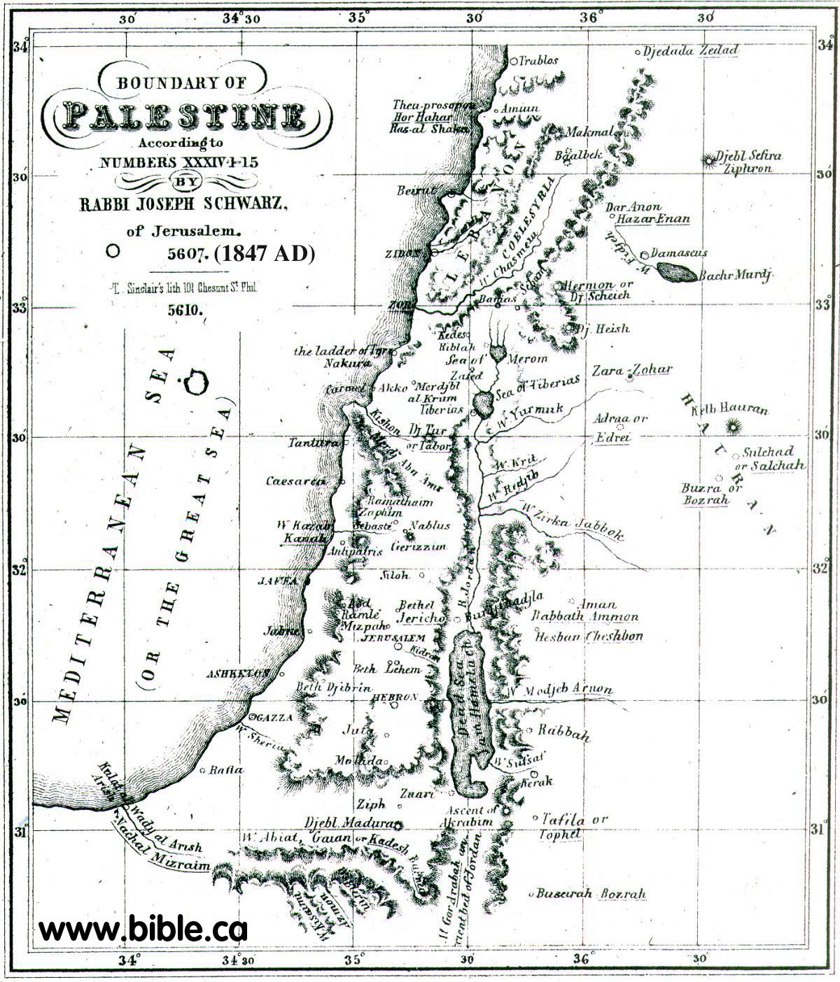
- This 1870 AD map shows the Exodus Route with Ein El Weibeh as Kadesh:
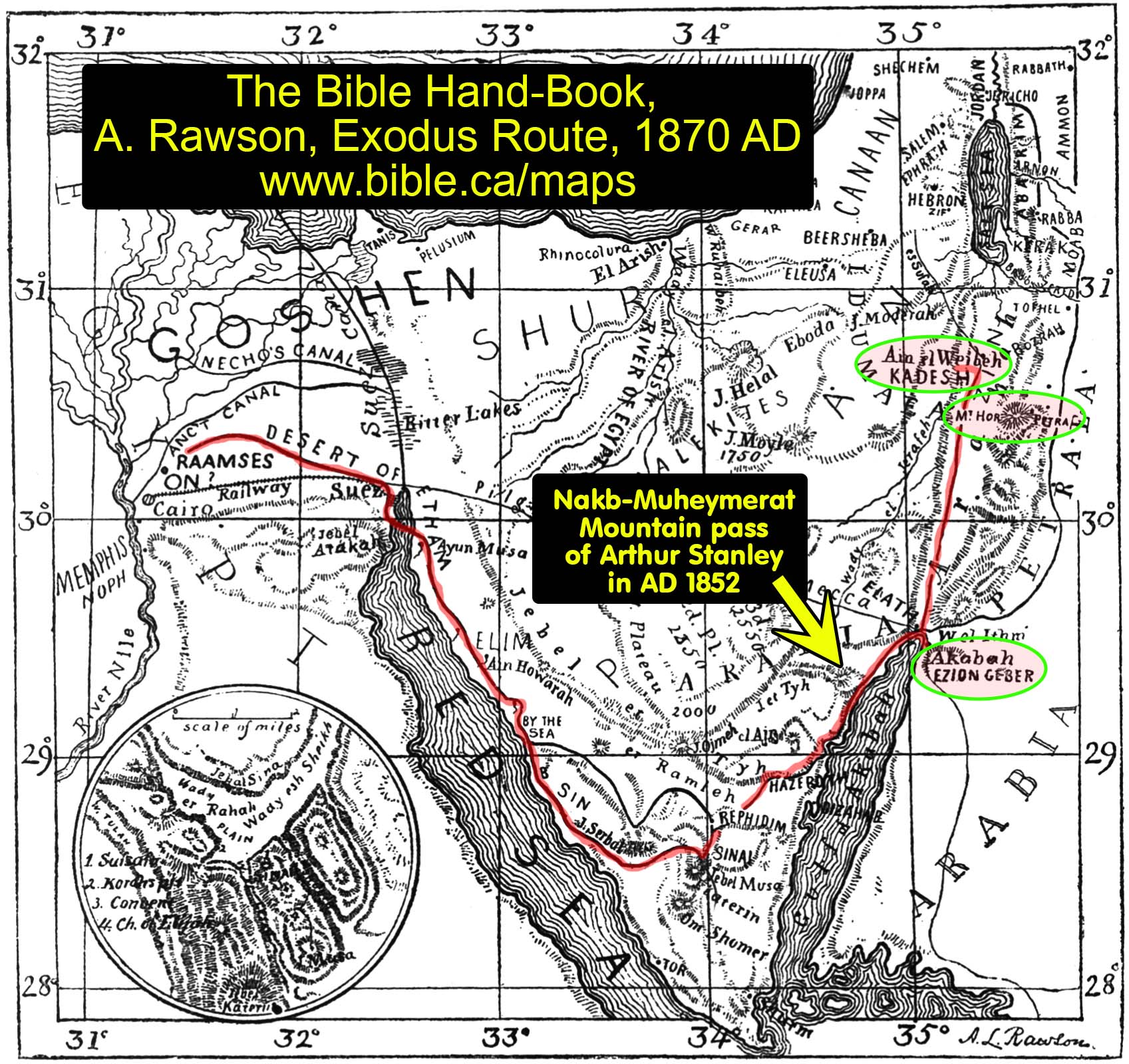
- Of course, neither of these could be Kadesh because the western edge of the Arabah valley was the Territory of Judah. Kadesh Barnea cannot be located Ein Hasb or Ein El Weibeh or Ein el Qudeirat for the same reason: Kadesh was not located within the promised land.
- In 1856, Arthur Penrhyn Stanley considered and rejected Weibeh and stated that Petra was the location of Kadesh. Stanley concluded with Petra as his choice for Kadesh: "Is it too much to suppose that this point and Mount Hor were long regarded as the two sacred spots-of Petra ; that the scene of the death and sepulcher of Aaron was designedly fixed in view of this, the innermost sanctuary of the Holy Place of " Kadesh ; " that this sanctity was retained through the successive changes of Pagan and Christian worship; and that the pilgrims of the Desert mounted these time-worn steps, and traced their inscriptions upon the rock, on their way to the only spot, whence they could see the grave of Aaron ? (Sinai and Palestine, in connection with their history, Arthur Penrhyn Stanley, 1856 AD, p84-99)
- Stanley lists all the historical connections with Kadesh at Petra: "It is moreover one of the few facts localized by anything like an authentic tradition,-in this case preserved by Josephus, the Talmudists, Eusebius, and Jerome, --that Kadesh was either identical, or closely connected with Petra." (Sinai and Palestine, in connection with their history, Arthur Penrhyn Stanley, 1856 AD, p84-99)
- Arthur Penrhyn Stanley rejected Weibeh and stated that Petra was the location of Kadesh. Of Mt. Hor he said: "It is one of the very few spots connected with the wanderings of the Israelites, which admits of no reasonable doubt." While he knew nothing of Nabatean history at Petra, his observations are correct. Today we know that the Nabateans arrived in Petra about 350 BC they found a vacant city of Hebrew tombs from the Exodus 1200 years earlier. Remember 2.5 million Jews died here. The Nabateans greatly enhanced the location with the elaborate carvings we see today. Being longstanding enemies of the Hebrews, they removed all traces of the Hebrew past, just like Pharaoh did in Egypt after Israel left Goshen. "If there be any ground for this conclusion, Petra assumes a new interest. Its rock-hewn caves may have served in part for the dwellings, in part for the graves of the Israelites." (Sinai and Palestine, in connection with their history, Arthur Penrhyn Stanley, 1856 AD, p84-99)
|
|
1881-1916 AD: Ein el Qedeis |
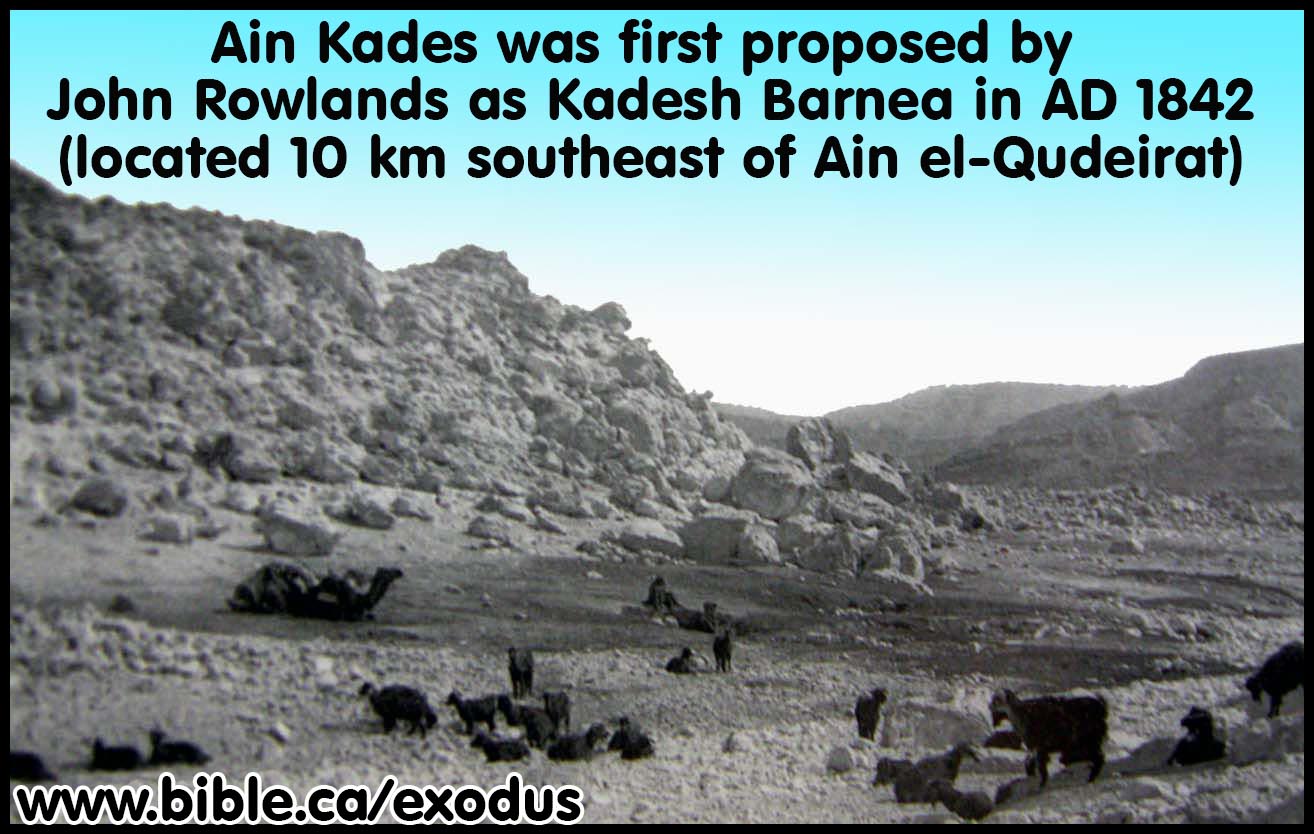
- 1842 AD: Ein Qedeis (Qudeis or Kadis or Kades) was first discovered in 1842 AD by John Rowlands and was the first to suggest a connection between the two names "Kadesh" [Barnea] and "Kadis".
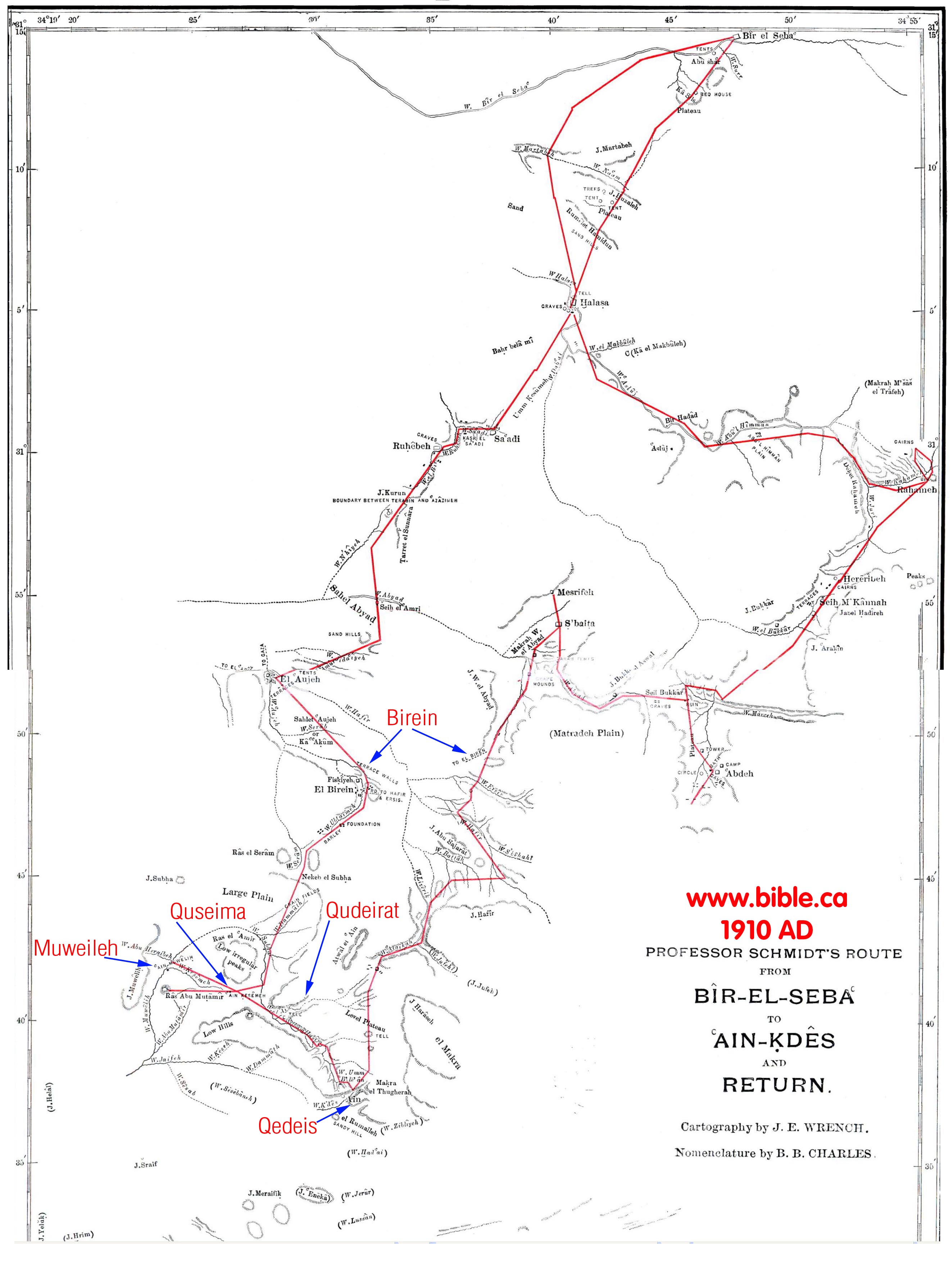
- In 1847 AD Rabbi Joseph Schwarz believed Kadesh was located a few miles north of Qedeis. In 1881 Trumbull referenced this location as a place he went past to get to Qedeis: "Running water gurgled under the waving grass. We had seen nothing like it [at Qedeis] since leaving Wady Fayran" (Kadesh-Barnea, Ein-Qedeis, Henry Clay Trumbull, 1884) Schwarz said: "Kadesh-Barnea. No geographer or traveller has hitherto succeeded to discover a trace of this place, But I believe that, through means of our own literary treasures, I shall be able to throw some light on this obscure name, so that it will be possible to fix its position with some degree of certainty. Our commentators Onkelos, Jonathan, and the Targum Yerushalmi, all translate Kadesh-Barnea with Rekam Gaya. In this connexion I have also discovered that the Wady al Arish (see farther down, under Nachal Mitzrayim), united eastwardly with another Wady, which the Arabs call Wady Abiat (White Valley), or Wady Gaian. Another Wady, called by them Wady Bierin, is connected on the southeast with the Wady Gaian. I have scarcely any doubt but that the name of Gaian is derived from the ancient Rekam Gaya, and that Bierin is derived from the ancient Barnea; although the Arabs believe that this name is applied to the Wady because there are found in it several wells. I therefore believe that the true position of Kadesh-Barnea is to be found at the point where the Wadys Gaian [ie. Fayran] and Bierin unite; and this is about 45 English miles south of Gazza." (Descriptive Geography and Brief Historical Sketch of Palestine, Rabbi Joseph Schwarz, 1847 AD) Map by Rabbi Joseph Schwarz in 1847 of promised land. You can locate Birein (Schwarz misspelled it Bierin) on the map by Nathan Schmidt. It is clear that Rabbi Joseph Schwarz did in fact sway the thinking of his time towards the Qedeis area for most of the early explorers referenced him and were aware of where Schwarz placed Kadesh.
- In 1872, Johann Heinrich Kurtz accepted Ein el Qedeis as Kadesh Barnea. See our comments below regarding Keil and Delitzsch using Kurtz in their commentary of the Bible at Num 12:16: "In October 1842 (according to the account given by Williams in his "Holy City" p. 487 sqq.), the two friends made an excursion beyond Hebron, for the purpose of putting to the test on the very spot, the accounts which still wavered as to the southern boundary of Palestine. They went from Arar (Araran, Aroer) towards the south-west, and ascended from the table-land of Arar, the first mountain rampart, by which it is bounded on the south. They now found themselves upon a still higher plateau, which stretches from east to west, and is called the Wady Rakmah. It answers to the district of the Dhullam and Saidiyeh on Robinson's map. After going still farther south, they ascended a second mountain-range, from the summit of which a scene presented itself to the view of the most magnificent character. (From statements made by Williams elsewhere, the point at which they now stood was somewhere about the longitude of Beersheba, twenty miles to the south of this place, near 31° north latitude, 32.5° longitude. A gigantic mountain towered above them in savage grandeur, with masses of linked rock, resembling the bastions of some Cyclopean architecture, the end of which it was impossible for the eye to reach towards either the west or the east. It extended also a long way towards the south; and with its rugged, broken, and dazzling masses of chalk, which reflected the burning rays of the sun, it looked like an unapproachable furnace, a most fearful desert without the slightest trace of vegetation. A broad defile, called Wady Murreh, ran at the foot of this bulwark towards the east, and after a course of several miles, on reaching the strangely formed mountain of Modder a (Maduran), it divided into two parts, the southern branch still retaining the same name and running eastwards to the Arabah, whilst the other was called Wady Fikreh, and ran in a north-easterly direction to the Dead Sea. " This mountain barrier," says Williams, " proved to us beyond a doubt, that we were now standing on the southern boundary of the promised land." They were confirmed in their opinion by the statement of the guide, that a few hours journey towards the south-west would bring them to Kadesh. 26. As you pass along the ordinary road to Hebron, on the western side of the mountainous district of the Azazimeh, the whole of the mountain-slopes between Jebel Araif and Jebel Khalil (or the heights of Hebron) appear to form a continued and unbroken range. But just as the separation of the mountains of the Amorites from the northern wall of the Azazimat, by the Wady Murreh, is concealed by the link which connects the two together to the east of Eboda; so do the projecting ranges of the western wall of the Azazimat keep out of sight an extended desert plain, which runs for many miles into the heart of the Azazimat on the other side of the Jebel Moyleh, and into which several wadys open from the eastern side of the mountain (e.g. the Wady Kesaimeh, the Wady Muweilih [ Moilahi], and the Wady Eetemat). "In the remote background, surrounded by the wilderness, there stands in a state of remarkable isolation the strong rock with its copious spring, —the spot which still bears the ancient name of Kadesh (Ain Kudés) (1), and of which Rowlands was the discoverer." That this is the wilderness of Kadesh, which plays so important a part in the history of the sojourn of the Israelites, is apparently no longer open to dispute (3). From the peculiar configuration of the soil, we may easily understand why this plain, which has a distinct name of its own (viz., Kadésh), should sometimes be regarded as a part of the desert of Paran (et-Tih), and at other times as belonging to that of Zin (the plain of Murreh) (2)." (History of the old covenant: Johann Heinrich Kurtz,1872 AD, Vol 3, Geological survey, p225-226)
- 1878 AD: It was again visited in 1878 AD by F. W. Holland.
- 1881 AD: Clay Trumbull visited Ein Qedeis in 1881 AD for only one hour, and then wrote an article in 1884 AD that formally stated that it was Kadesh Barnea. Trumbull flagrantly lied and exaggerated his account of Ein Qedeis saying, "It was a marvelous sight! Out from the barren and desolate stretch of the burning desert-waste, we had come with magical suddenness into an oasis of verdure and beauty, unlooked for and hardly conceivable in such a region. A carpet of grass covered the ground. Fig trees, laden with fruit nearly ripe enough for eating, were along the shelter of the southern hillside. Shrubs and flowers showed themselves in variety and profusion. Running water gurgled under the waving grass. We had seen nothing like it since leaving Wady Fayran ; nor was it equalled in loveliness of scene by any single bit of landscape, of like extent, even there. ... There was a New England look to this oasis, especially in the flowers and grass and weeds; quite unlike anything we had seen in the peninsula of Sinai. Bees were humming there, and birds were flitting from tree to tree. Enormous ant hills made of green grass-seed, instead of sand, were numerous. As we came into the wady we had started up a rabbit, and had seen larks and quails. It was, in fact, hard to realize that we were in the desert, or even near it." (Kadesh-Barnea, Ein-Qedeis, Henry Clay Trumbull, 1884 AD, p273-275)
- William Smith was perhaps the first to be influenced by Trumbull and wrote this entry in his Bible dictionary: "There has been much doubt as to the exact site of Kadesh; but Rev. H. Clay Trumbull of Philadelphia, visiting the spot in 1881, succeeded in rendering almost certain that the site of Kadesh is Ain Kadis (spelled also Gadis and Quadis); "the very same name, letter for letter in Arabic and Hebrew, with the scriptural fountain of Kadesh --the 'holy fountain,' as the name means-- which gushed forth when Moses smote the rock." (Kadesh, William Smith's Bible Dictionary, 1884 AD)
- Between 1872 - 1891 in their commentary on the Bible at Num 12:16, Keil and Delitzsch rejected a transjordan location for Kadesh Barnea on the basis of what Johann Heinrich Kurtz reported in his History of the old covenant: 1872 AD, Vol 3, Geological survey, p225-226. Keil and Delitzsch said this: "See Kurtz, History of the Old Covenant, vol. iii. p. 225, (History of the old covenant : Johann Heinrich Kurtz,1872, vol, 3 p 225) where the current notion, that Kadesh was situated on the western border of the Arabah, below the Dead Sea, by either Ain Hasb or Ein El Weibeh, is successfully refuted." (Keil and Delitzsch, Num 12:16, footnote) When you read Kurtz's actual evidence that Kadesh Barnea could not be transjordan, this is what Kurtz said: ""This mountain barrier," says Williams, "proved to us beyond a doubt, that we were now standing on the southern boundary of the promised land." They were confirmed in their opinion by the statement of the guide, that a few hours journey towards the south-west would bring them to Kadesh." Kurtz also makes several enormous errors in his account while describing a location of Ein El Weibeh on the western edge of the Arabah Valley. First he thinks Ein El Weibeh is at the same longitude as Beersheba. The intersecting line of the latitude is 30 miles due west of where he is standing. In fact Beersheeba is 40 miles NW of where he is standing. Then he notes the Bedouin says Ein el Qedeis is only 2 hours away, when it is in fact 50 miles away, likely a 3 day journey, knowing the terrain. Exactly why this unknown mountain barrier would have any bearing on locating the southern boundary of the promised land is a mystery, and is purely speculative therefore worthless. The real reason Keil and Delitzsch and Kurtz believe Kadesh cannot be transjordan is because the Bedouin guide told them that Ein el Qedeis preserves the name "Kadesh". This association has since been utterly rejected. Ein el Qedeis was rejected in 1914, in favour of Ein el Qudeirat, located about 6 km NW of Ein el Qedeis. So in the end, the very association of the name in the mind of the Bedouin guide proved absolutely nothing. Keil and Delitzsch relied upon Kurtz's account which was full of errors. This means they have no good reasons why Kadesh Barnea cannot be transjordan even though the reasons sounded convincing at the time. This comedy of errors underscores how little the explorers knew 100 years ago.
- In 1896 AD, Kades next visited by Lagrange: In 1910, Schmidt (who himself visited Kades in 1905 AD) recounts the visit of Lagrange in 1896 AD: "No wonder that the next visitor, J. Lagrange, who came from El Natal to 'Ain Kades on the 11th of March, 1896, confesses that "the deception was so strong, the disenchantment so deep, that I prevailed on the sheik Suleiman while shouting that he brought us to the wrong place.) Suleiman swore by the Prophet that it was 'Ain Kades." There was the rock with some wasms on it, the water, the channel, an occasional tuft of grass, and a few wild figs; but no marble, no vegetation, no color, no life, no oasis of verdure and beauty. Lagrange's description shows that only fifteen years after Trumbull's visit, and at the same time of the year, the place presented very much the same appearance that it did to myself in 1905." (Kadesh Barnea, Journal of Biblical Literature, Nathan Schmidt, Vol 29, no 1, 1910 AD, p69)
- In 1901 AD, Robinson comments on Trumbull's deception echoing what Lagrange said in 1896. "The last to visit Ein Qedeis was Rev. H Clay Trumbull, editor of the Sunday-School Times, who in 1881 rediscovered the site, describing his search for it at length in his scholarly work entitled Kadesh-Barnea (1884), but whose actual description of the 'Ain (pp. 272 f.), we regret to say, is more rhetorical than scientific." (Modern Kadesh or Ein Kadis, George L. Robinson, The Biblical World, Vol. 17, No. 5., May, 1901AD)
- Robinson noted that in spite of Trumbull's deceptive description of Kades, he and most of the world scholars still viewed Kades as Kadesh Barnea: "It is pretty generally agreed now that Kadesh of Scripture is probably the same as Ein Qedeis, or "Holy Fountain," of the Arabs. This is the opinion of Rowlands, who first identified it; of Ritter and Schultz ; of Palmer and Dr. H. Clay Trumbull; of Guthe also" (Modern Kadesh or Ein Kadis, George L. Robinson, The Biblical World, Vol. 17, No. 5., May, 1901AD)
- In 1910 AD, Nathan Schmidt was next to visit Kades and he makes this comment on Trumbull's deceptive description of the place: "On March 30th, 1881, H. Clay Trumbull came to 'Ain Kades from the south. There can be no question that the picture he afterwards drew of this "oasis of verdure and beauty" was altogether too richly colored. Even when the greatest allowance is made for the season of the year, the contrast to the desert of El Tih, the keen expectancy and the joy of discovery, the later visitor cannot help asking in amazement what has become of all the marble, the carpet of grass, the fruit-laden trees, the warbling birds, and the "New England look" of the landscape, or what would have happened if the eager explorer had been taken to Ain Kades before the marvelous sight " of all this loveliness had burst upon him. His learned and valuable treatise on Kadesh Barnea in part makes amends for a manifest want of sobriety in the description of what is supposed to be its modern site. (Kadesh Barnea, Journal of Biblical Literature, Nathan Schmidt, Vol 29, no 1, 1910 AD, p69)
- Nathan Schmidt noted that the water quality at kades was good but not much else: "The water that was brought up from the fountain for the evening meal was of an excellent quality. ... Aside from the water, there is nothing very impressive about 'Ain Kades. (Kadesh Barnea, Nathan Schmidt, Journal of Biblical Literature, Vol 29, no 1, 1910 AD, p69,71)
- Schmidt wondered if Trumbull had mixed up Kades with Qudeirat in his mind when he wrote his report as a way of explaining the lavish description of Trumbull. This explanation fails because Trumbull's account of Ein El Qedeis doesn't fit Qudeirat much better. "It is not as easy as it has seemed to those influenced by Trumbull's descriptions and the modern name to decide whether 'Ain Kades is more likely to have been Kadesh Barnes than 'Ain Kderat. The latter is the fountain par excellence in this region; it is El 'Ain. The sheltered position, the broad stream of water, the comparatively luxuriant vegetation, the impressive "tell," the well-constructed pool, the traces of ancient buildings, clearly indicate the importance of this place. It seems to me altogether probable that this is the site of the city of Paran, the ? of Judith 1:9 and 5:14, the Byzantine Cadis and the Kadesh Barnea of the Crusaders. It is not impossible that the stream flowing down Wadi el 'Ain was once called Me Meribath Kadesh." (Kadesh Barnea, Nathan Schmidt, Journal of Biblical Literature, Vol 29, no 1, 1910 AD, p73)
- In 1910 AD, Nathan Schmidt, after considering Weibeh, Kades and Qudeirat, rejected them all and concluded that Kadesh was in fact at Petra: In choosing the location of Kadesh, Schmidt rejected Qudeirat in favor of Petra in 1910 the same way that Stanley rejected Weibah in favor of Petra in 1856: "It seems to me even more probable that Petra was the original scene of these stories. Here the great Deliverer (Cp. my article "The Jerahmeel Theory and the Historic Importance of the Negeb," Hibbert Journal, vi. 2 January, 1908, pp 339ff.) performed the miracle of piercing the rock and sending the wonderful stream through the Sik, and here his older brother Aaron died on the peak of Mt. Hor. In earlier times the gulf of 'Akabah reached farther north than it does to-day, and a passage from the eastern side over to El Tih may not have been as easy as it is at present. Nomadic tribes pushing northwest from the land of Midian no doubt found their way down into the Negeb through the defiles of Mt. Seir (Jebel Sharra). The Idumaean clans that camped around Moserah and Zin probably brought with them the traditions of their heroes. Their way from Sinai-Horeb to Kadesh Barnea and Mt. Halak is likely to have led them through the Valley of Moses and put the reputed resting-place of Aaron in Petra." (Kadesh Barnea, Nathan Schmidt, Journal of Biblical Literature, Vol 29, no 1, 1910 AD, p75-76)
- In 1914 Leonard Woolley and T. E. Lawrence visited Kades and commented on the deception of Trumbull: "Mr. H. C. Trumbull, an American, spent a single hour at the spring in 1882, and wrote round his visit a very large book. with fantastic descriptions of the valley ... As a general comment we can only say that this account is as minutely accurate in its measurements as it is inaccurate in its descriptive matter. The valley of Ain Kadeis is unusually naked, even among the valleys of the south country. " (The Wilderness of Zin, C. Leonard Woolley and T. E. Lawrence, CH IV, Ain Kadeis And Kossaima, 1914-1915 AD)
- "The actual site of Kadesh-Barnea has long been a subject of scholarly dispute. The earliest 19th century investigators, men like Karl von Raumer and Edward Robinson, looked for Kadesh-Barnea in the Aravah, the deep geomorphic rift extending from the southern end of the Dead Sea to the Red Sea. Based on the reference in Numbers 20:16 to Kadesh as being on the border of Edom and the fact that the Aravah was thought to be the western border of Edom, various oases in the Aravah were proposed as the site of Kadesh-Barnea. In the 1880s, Henry Clay Trumbull suggested Ein-Qedeis, in the northern Sinai, as the site of Kadesh-Barnea. What appeared to be the retention of the Biblical "Kadesh" in the Arabic "Qedeis" was a forceful and appealing argument in favor of Trumbull's identification. Moreover, Trumbull described Ein-Qedeis as a luxuriant oasis which seemed to fit the Biblical description of the site. Unfortunately, Trumbull's description of Ein-Qedeis was highly romanticized. In fact, Ein-Qedeis is a shallow pool of water surrounded by a desert wasteland. Ein-Qedeis could not have been a major ancient center like Kadesh-Barnea." (Did I Excavate Kadesh-Barnea? absence of Exodus remains poses problem, Rudolph Cohen, 1981 AD)
- The New Advent Catholic encyclopedia was probably the last to say that Kadesh was located at Qedeis in 1917 AD: "A good deal of controversy has existed concerning the site of Cades, no less than eighteen places having been proposed. This may now be considered as settled in favour of 'Ain Qadis or Gadis, discovered by J. Rowlands in 1842, fifty miles south of Beersheba. Its only serious rival, 'Ein El-Weibeh, on the western edge of the Arabah, forty-five miles farther east, which was advocated by Robinson and others, is now generally abandoned. 'Ain Qadis ("Holy Well") preserves the name Cades both in meaning and etymology, and best satisfies the scriptural data." (New Advent Catholic encyclopedia, Cades, 1917 AD)
- The Map by Nathan Schmidt of Kades and Qudeirat. (Kadesh
Barnea, Nathan Schmidt, Journal of Biblical Literature, Vol 29, no 1,
1910 AD, p68)
|
|
1916 -2005 AD: Ein el Qudeirat |
- In 1882, after Henry Clay Trumbull's one hour visit to Qedeis and choosing it as Kadesh Barnea, he traveled 6 km north to visit Ein El-Qudeirat. Like his deceptive account of the greenery at Qedeis, his account at Ein El-Qudeirat were also full of lies. He talked about dense vegetation and a 60 foot wide river and a 14 foot waterfall at Ein El-Qudeirat. Today, most of the vegetation is the result of modern irrigation techniques and it still isn't as "lush" as Trumbull described it. AYN EL-QADAYRAT DISCOVERED: The signs of fertility in this spur were far greater than in the main wady. Grass and shrubs and trees were in luxuriance, and the luxuriance increased at every step as we pushed on. One tree, called by our Arabs a " seyal " (or acacia), but not showing thorns like the acacias of the lower desert, exceeded in size any tree of the sort we had ever seen. Its trunk was double ; one stock being some six feet in girth ; the other, four feet and a-half. The entire sweep of the branches was a circumference of nearly two hundred and fifty feet, according to our pacing of it. "With such trees as that in the desert, it were easy enough to get the seyal, or shittim. wood, of suitable size for the boards and bars of the tabernacle. Still the luxuriance of vegetation increased. Then, as we proceeded, came the sound of flowing, and of foiling water. A water channel of fifteen to twenty yards in width, its stream bordered with reeds or flags, showed itself at our feet between the hills. We moved eastward along its southern border. Above the gurgling sound of the running stream, there grew more distinct the rush of a torrent-fall. As we pressed toward its source, the banks of the stream narrowed and rose, and we clambered them, and found our way through dense shrubbery until we reached the bank of the fountain-basin. There we looked down into a pool some twelve to fourteen feet below us; into which a copious stream rushed from out the hillside at the east, with a fall of seven or eight feet. The hillside from which this stream poured was verdure-covered, and the stream seemed to start out from it, at five or six feet below our level. The dense vegetation prevented our seeing whether the stream sprang directly out of an opening in the hillside, or came down along a concealed channel from springs yet farther eastward; but the appearance was of the former. Waving flags, four or five feet high, bordered this pool, as they bordered the channel below it. Our dragoman enthusiastically compared the fountain to that of Banias, away northward, at the source of the Jordan. It was certainly a wonderful fountain for the desert s border. Its name Ayn el-Qadayrat the " Fountain of Omnipotence," or " Fountain of God s Power," was not inappropriate, in view of its impressiveness, bursting forth there so unexpectedly, as at the word of Him who " turneth the wilderness into a standing water, and dry ground into water springs." No wonder that this fountain was a landmark in the boundary line of the possession, which had been promised of God to his people, as " a land of brooks of water, of fountains and depths that spring out of valleys and hills." Viewed merely as a desert-fountain, Ayn el-Qadayrat was even more remarkable than Ayn Qadees ; although the hill-encircled wady watered by the latter, was far more extensive than Wady Ayn el-Qadayrat; and was suited to be a place of protected and permanent encampment, as the latter could not be. Perhaps it ought to be mentioned, that the "date-palms " which Scetzen spoke of as watered by this fountain, were not seen by us. Yet they may have been elsewhere; or indeed, they may have existed in his day, although not now remaining. There was a peculiar satisfaction in looking at this remarkable fountain, when at last we had reached it. No visit to it had been recorded by any traveler in modern times. Seetzcul and Robinson, and Rowlands, and Bonar and Palmer, and others, had been told of it, and had reported it accordingly; but no one of them claimed to have seen it. In view of all that these travelers had said, and after his own careful search for it, up and down the wady, Bartlett, (as has already been mentioned) had come to the conclusion that no such fountain existed that, in fact, Wady el-Ayn, the Wady of the Well, was a wady without a well. To put our eyes on it, therefore, the very day of our seeing Ayn Qadees, was enough to drive out of mind all thought of our dangers and worry on the way to it. We congratulated one another all around; and Muhammad Ahmad was promised anew that he should go into that book" Silk Bazar," and all." (Kadesh-Barnea Henry Clay Trumbull, 1884 AD)
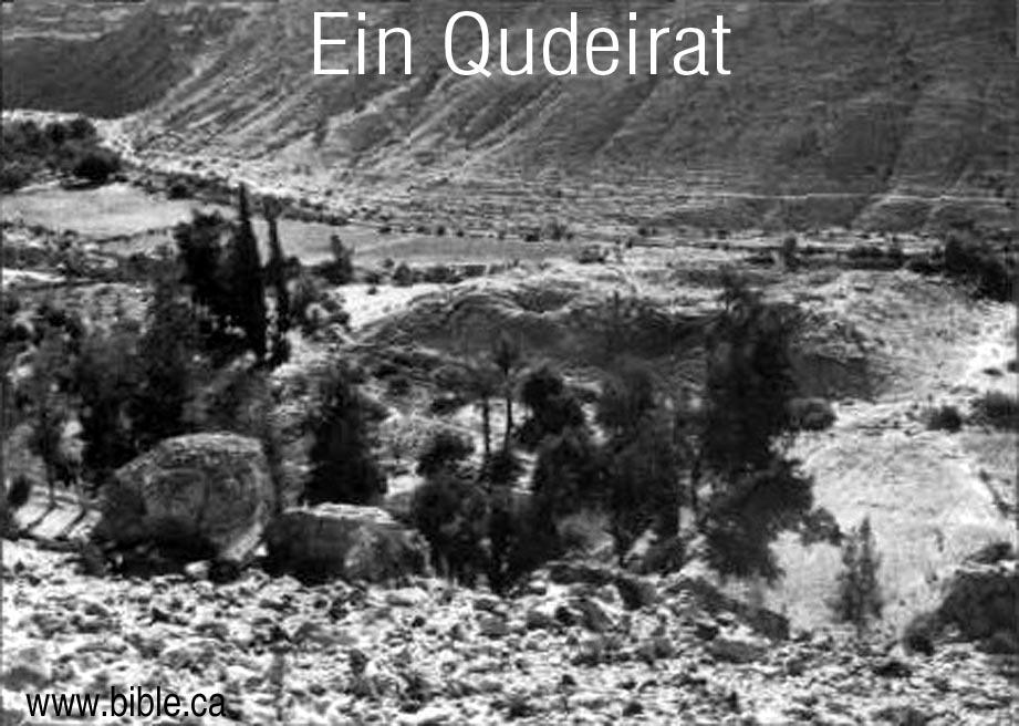
- In 1905 Nathaniel Schmidt visited Qudeirat and rejected it as Kadesh and chose Petra instead. In 1981 AD, Rudolph Cohen misrepresented Nathaniel Schmidt as the first one to identify that Ein el-Qudeirat was Kadesh. In fact Schmidt considered Weibeh, Kades and Qudeirat, rejected them all and concluded that Kadesh was at Petra: "It seems to me even more probable that Petra was the original scene of these stories." (Kadesh Barnea, Nathan Schmidt, Journal of Biblical Literature, Vol 29, no 1, 1910 AD, p75-76) Cohen says: "In 1905, Nathaniel Schmidt first identified Kadesh-Barnea as the modern site of Ein el-Qudeirat. Schmidt marshalled his arguments: "The sheltered position, the broad stream of water... Its strategic location on two important ancient routes, its abundance of water and its correspondence with Biblical geography makes this the most likely candidate; no other site offers a convincing alternative. ... The springs of Ein el-Qudeirat are the richest and most abundant in the Sinai; they water the largest oasis in northern Sinai." (Did I Excavate Kadesh-Barnea? absence of Exodus remains poses problem, Rudolph Cohen)
- In 1914, Woolley and Lawrence compared the two sites of Qedeis and Qudeirat and decided that Kadesh Barnea was somewhere in the Quseima district, most likely at Qudeirat, since it was the largest of four springs: "Strategically the Kossaima district agrees well with what we know of Kadesh-Barnea. ... These roads running out to north, south, east and west - all directions in which journeys were planned or made from Kadesh-Barnea - together with its abundance of water and wide stretch of tolerable soil, distinguish the Kossaima plain from any other district in the Southern Desert, and may well mark it out as the headquarters of the Israelites during their forty years of discipline.(The Wilderness of Zin, C. Leonard Woolley and T. E. Lawrence, CH IV, Ain Kadeis And Kossaima, 1914-1915 AD)
- Woolley and Lawrence knew that they would have to abandon the traditional location of Mt. Hor beside Petra and chose a new location of the burial place of Aaron, basically at random: "To choose today out of the innumerable hills of the country one particular peak to be the scene of Aaron's burial shows, perhaps, an uncatholic mind; but as long as the tradition of Jebel Harun passes muster, so long the existence of recognized roadways between the mountain and the Kossaima plain must influence our judgment." (The Wilderness of Zin, C. Leonard Woolley and T. E. Lawrence, CH IV, Ain Kadeis And Kossaima, 1914-1915 AD)
- Woolley and Lawrence published their book in 1916 AD in which they chose Ein El-Qudeirat as Kadesh Barnea, and the entire world jumped on board with them.
- Woolley and Lawrence really had only superficial information when they chose Qudeirat as Kadesh. They made many mistakes typical of the science of archeology of the time. For example, at Tell el-Kheleifeh (ancient Elat) "Glueck threw out most of the common wheel-made pottery he excavated; he did not realize this common wheel-made pottery was far more reliable for dating purposes than the handmade pottery he saved.)" (Jezirat Faraun: Is This Solomon's Seaport?, Alexander Flinder, 1989 AD) This was 25 years after Woolley and Lawrence excavated at Qudeirat. Who knows what errors they made?
- It is interesting that Woolley and Lawrence wrongly wondered if the fort at Qudeirat already existed when Moses arrived. Of course, this was in 1916 AD and now we know that the remains at Quderat were built some 400 years after Moses, by Solomon. Today, we know that Ein El-Qudeirat, is not even Kadesh Barnea, so Moses was never even here: "At a later date Moses, writing to the King of Edom, described Kadesh as `a city in the uttermost of thy border' (Numbers xx, 16). The word `city' is a vague one, and probably only means a settlement, perhaps a district, like the modern Arabic beled which is used to mean town, village, district, or country. In the former sense it might be used of such hut-settlements as those of Muweilleh and Kossaima; but would most temptingly apply to the fortress of Ain Guderat [Qudeirat], should we assume - we cannot prove it - that the fort was already built when Moses came." (The Wilderness of Zin, C. Leonard Woolley and T. E. Lawrence, CH IV, Ain Kadeis And Kossaima, 1914-1915 AD)
- Excavations at Qudeirat were carried out 1914-1915 AD by Woolley and Lawrence. They published their finds in the book The Wilderness of Zin. This book convinced the world that Qudeirat was in fact Kadesh and so it so to the present time.
- Shortly after 1916 AD, the world rejected Ein El Qedeis for Kadesh. The new location for Kadesh was about 10 km north at Ein el-Qudeirat after Woolley and Lawrence published their book. Qudeirat has been the almost undisputed location for Kadesh Barnea from 1916 to the present time. However Qudeirat simply cannot be Kadesh Barnea for a long list of reasons discussed elsewhere.
- Today Ein El-Qudeirat is still the location for Kadesh Barnea in almost every Bible map produced. This is a grave mistake since Kadesh Barnea is located transjordan, near or at Petra, right where Josephus and Eusebius in the Onomasticon said it was.
2005 AD - present: Petra area, eastern Arabah Valley, Transjordan
- The Author seeks to restore the true exodus route that the first century Christians believed: A crossing crossing point of the Red Sea at the Straits of Tiran; a location for Mt. Sinai in Arabia (perhaps at Lawz) and a transjordan location of Kadesh Barnea (the Petra area at Beidha, 5 km north of Petra).
- This of course is not really a discovery, but more of a restoration in harmony with the Bible and the most ancient history sources combined with modern archeology.
- It is my hope that the many errors in almost every map in every Bible will be corrected to reflect true Bible geography.
Conclusion:
- Kadesh Barnea is located at or near Petra at Beidha.
- Click here to learn the true location of Kadesh Barnea!
By Steve Rudd: Contact the author for comments, input or corrections.
