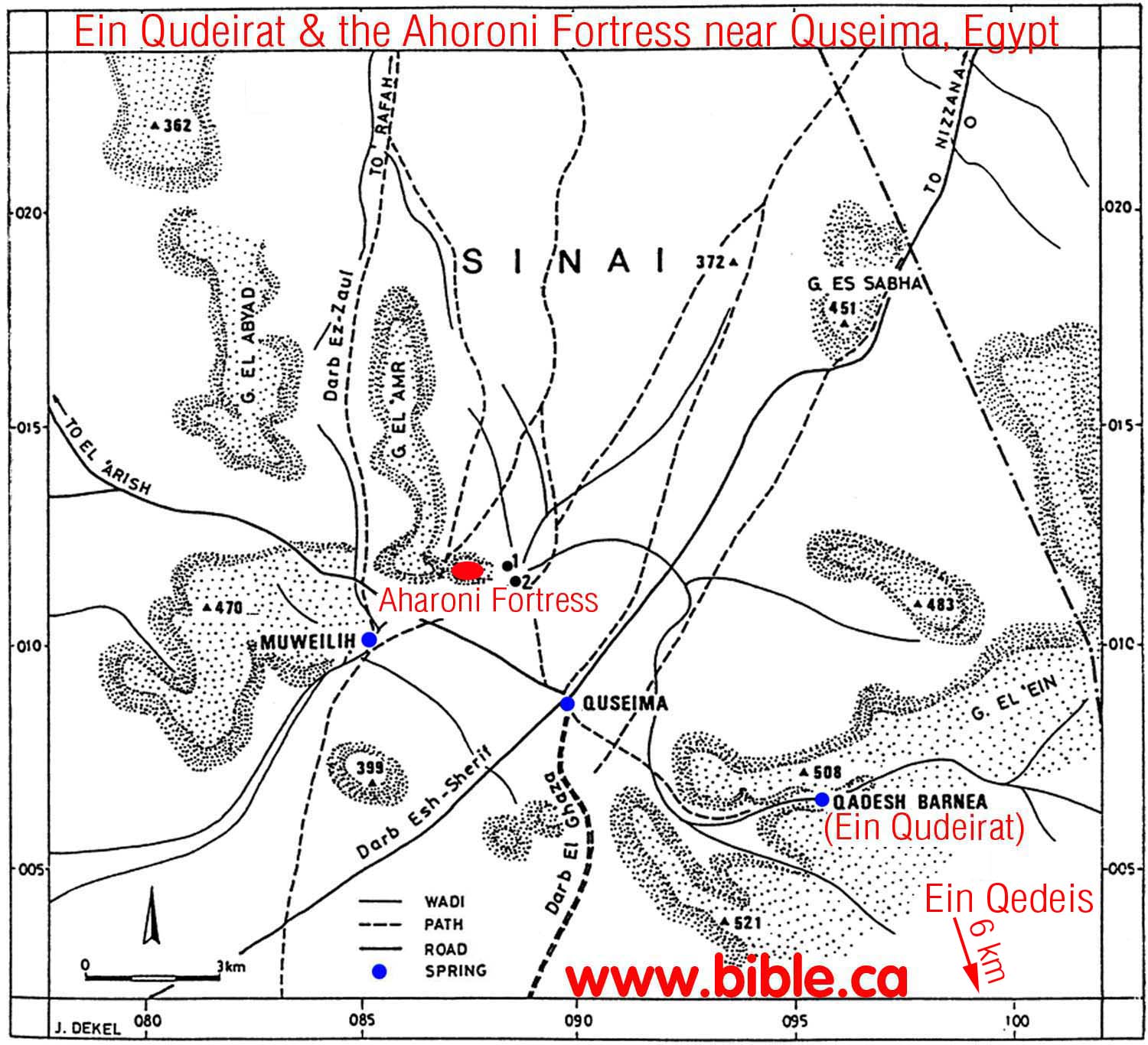
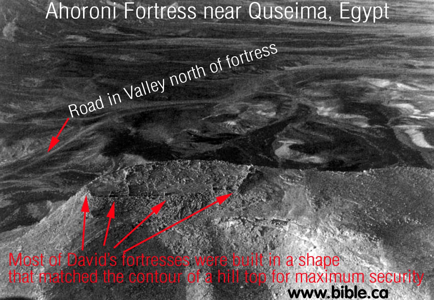
The Ahoroni Fortress at Quseima:
(One of Solomon's network of military border fortresses)
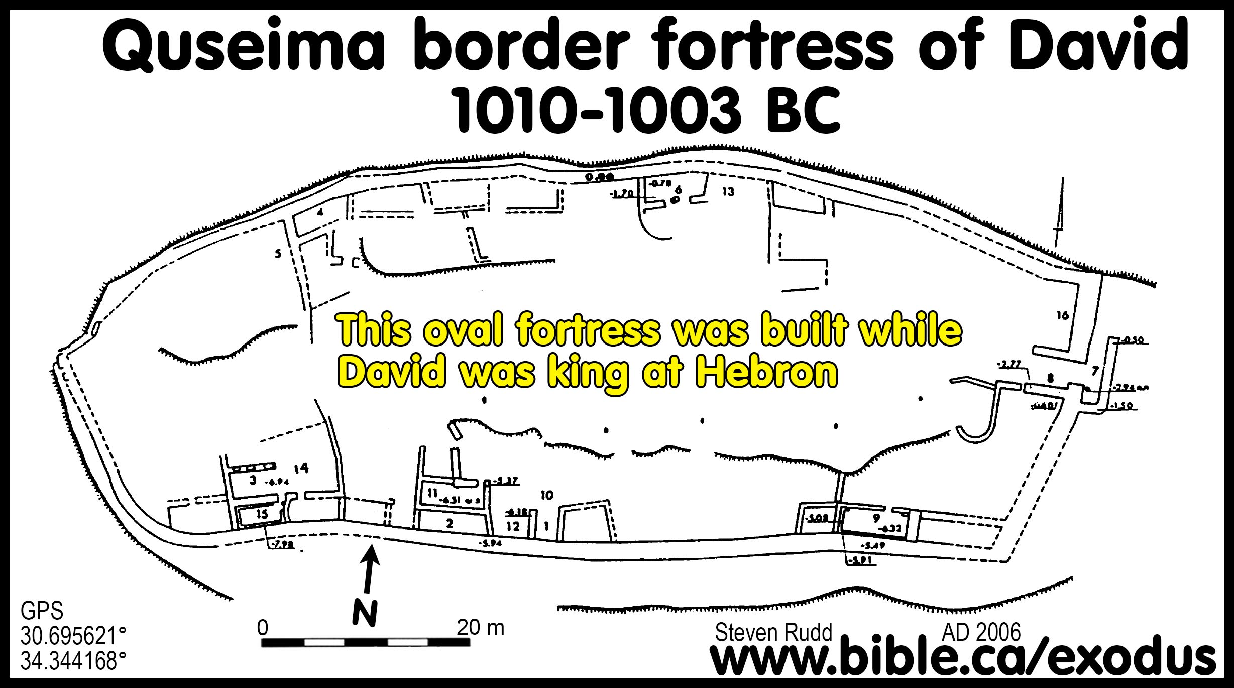
Map of the Quseima area:
Introduction:
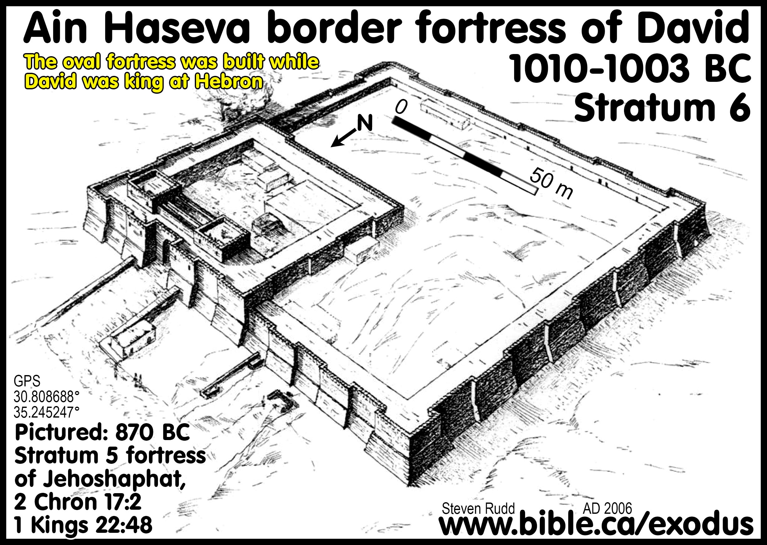
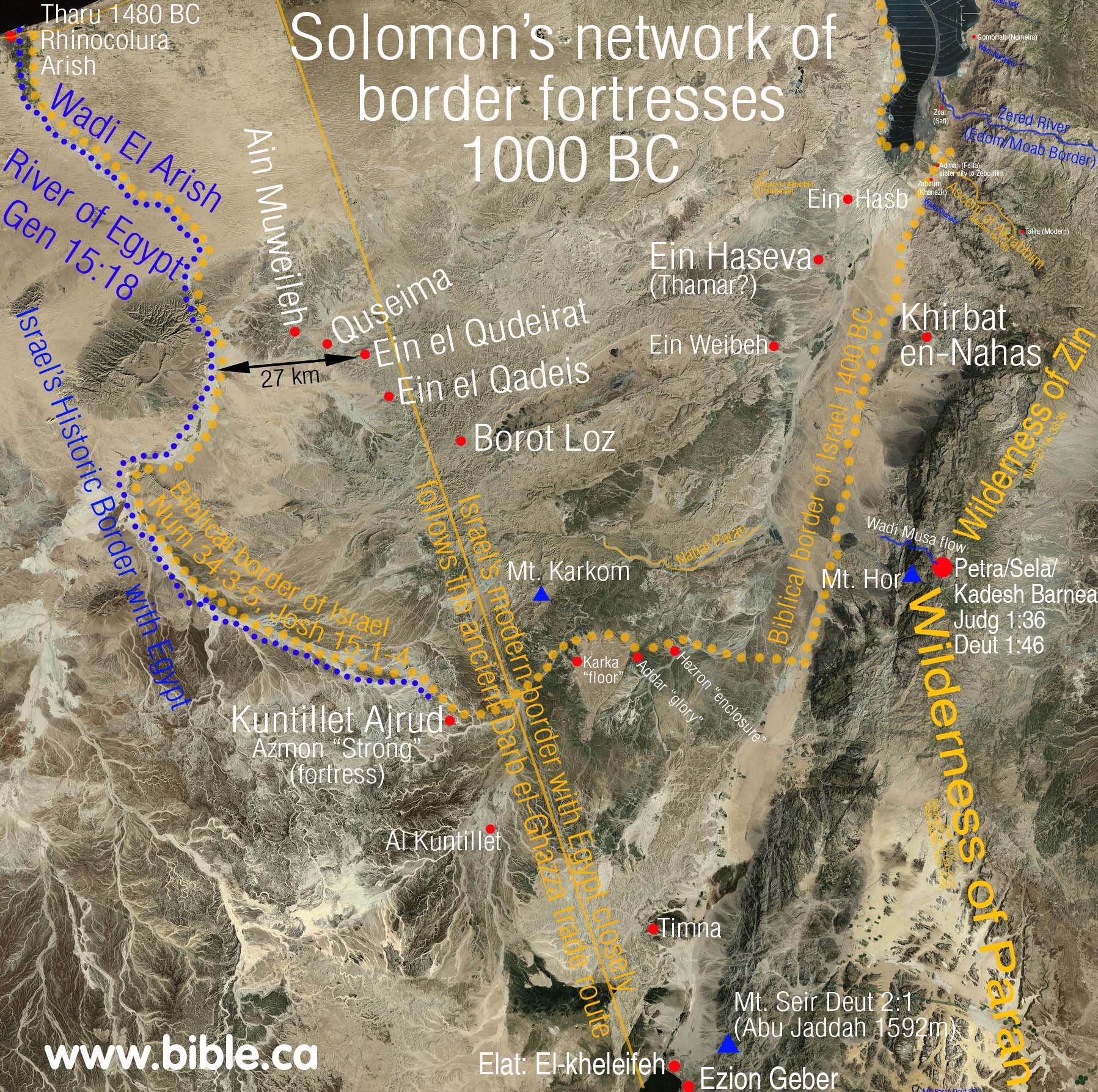
Solomon's border fortress at Quseima is the largest of over 50 that have been discovered because of its strategic location. The summit was able to watch over three of four springs in the area. Only Qedeis was out of visual site.
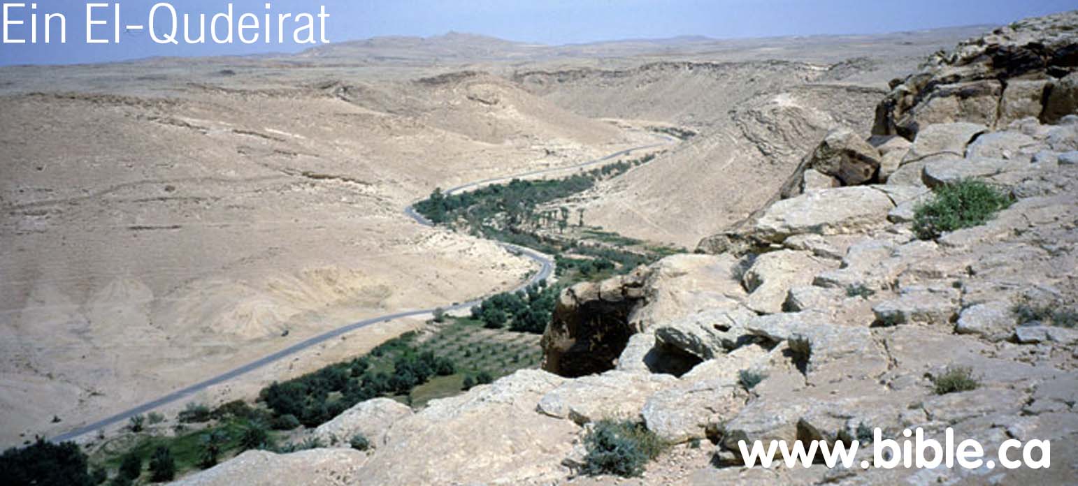
Quseima is the center of a four major ancient crossroads (Darb Esh-Sherif, Darb El Ghazza, Darb Ez Aaul, Darb El Arish) and four nearby springs of water: The two smaller springs at Quseima and Ein Muweileh. A larger spring at Qedeis and the largest spring at Qudeirat. Quseima was the center of the largest water supply in the Sinai.
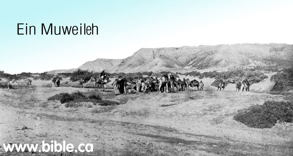
Ein Muweileh just west of Quseima.
Solomon built three border fortresses in close proximity to three of the springs: Quseima and Qudeirat and Qedeis. From a strategic point of view, the Quseima fortress was the most important because it was the most westerly and therefore closest to the Egyptian border and it overlooked the crossroads. The border between Egypt and Israel as stated in the Bible, is the wadi el-Arish.
The family of three military border fortresses built in 950 BC by Solomon at Quseima, Qudeirat and Qedeis proves our point that they cannot be used a proof that this is where Kadesh Barnea was located.
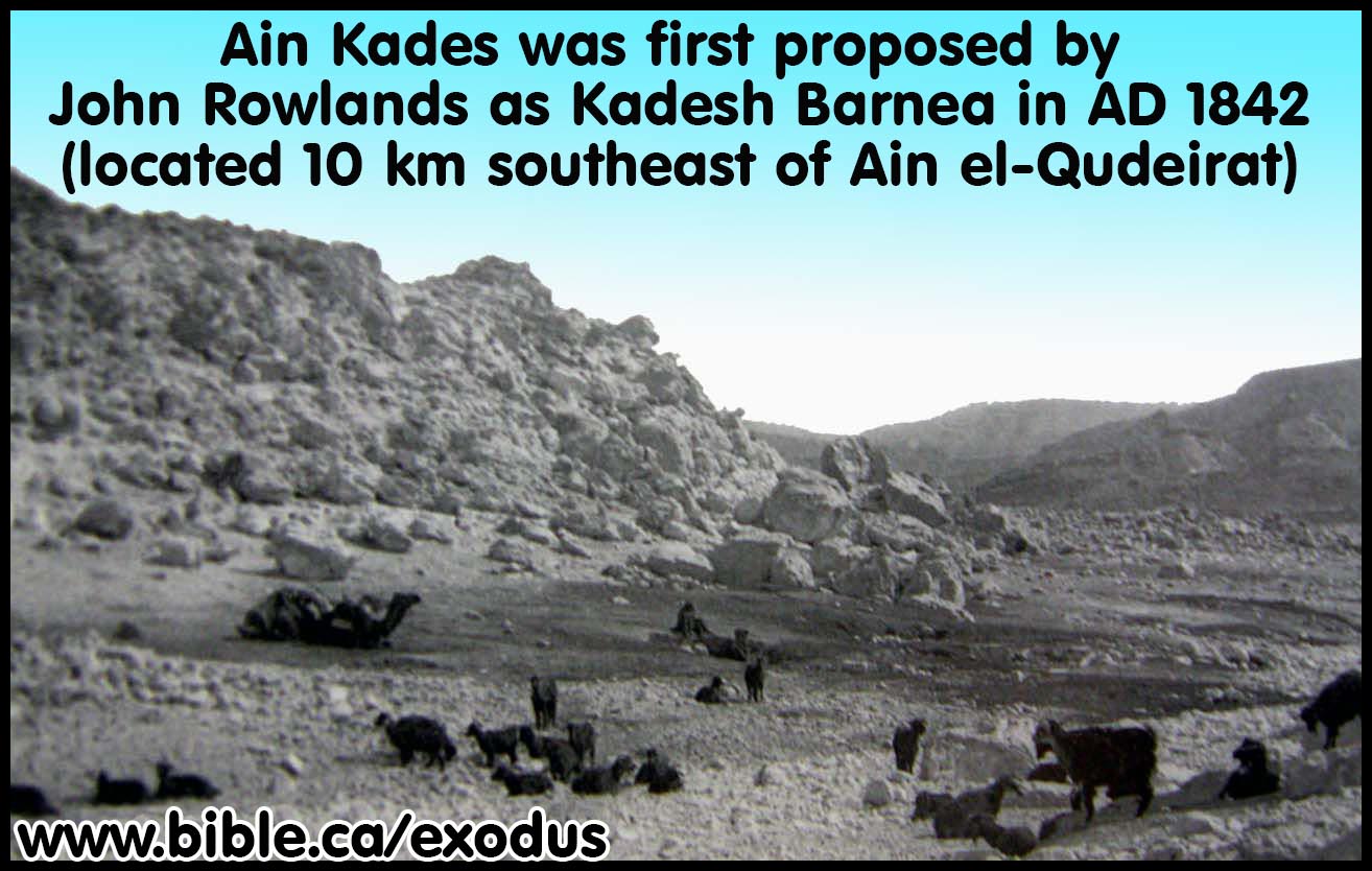
The Ahoroni Fortress near Quseima, Egypt is one of over 50 outposts built by king Solomon to protect the border between Israel and Egypt, which lie about 19 km west of Quseima and about 26 km west of Ein Qudierat and Ein Kades. (Ein Kades is located about 6 km south west of Qudeirat).
"The site, [Ahoroni Fortress] named for the late Y. Aharoni, be-longs to the category of "Israelite fortresses," of which some 50 have been discovered in the Negev Highlands. ... According to the general plan of the site and the finds, it may clearly be classified as one of the "Israelite fortresses in the Negev."" ("Aharoni Fortress" near Quseima, Zeev Meshel, 1994 AD)
A. Date of the fortress at Quseima:
"The sites have produced no Midianite ware or other types that might imply a much earlier date. The exact date of construction could be anywhere between the late 11th and the mid-10th century. This wide margin enables some scholars to base their conjectures on historical interpretation or models of some sort (e.g., King Solomon as builder and Shishak as destroyer), rather than on typological considerations. Thus, Herzog proposes an 11th century date (Herzog 1990: 238); and Finkelstein, true to his multistage theory, dates the whole process to the end of the 11th and beginning of the 10th centuries (Finkelstein and Perevolotsky 1990: 78). This means that the oval fortresses were built in the 11th century, with the smaller fortresses and settlements coming somewhat later. Dating is, of course, crucial for both theories: a date earlier than the establishment of the kingdom of Israel would settle the argument once and for all. But as long as no finds permitting an unambiguous dating have surfaced, the controversy will continue." ("Aharoni Fortress" near Quseima, Zeev Meshel, 1994 AD)
B. Strategic Location of Quseima:
"The summit, 390 m above sea level, rises some 140 m above the surrounding plain, permitting excellent observation in three directions. Among the more prominent points visible from the summit are the tip of the Qadesh Barnea oasis and the little oasis of Quseima, as well as Tin Muweilih. If there is any connection between the fortress and the routes formerly running through the plain, the fortress was clearly an excellent lookout point." ("Aharoni Fortress" near Quseima, Zeev Meshel, 1994 AD)
"Nearby, there is an ancient crossroad: one road runs from Suez to Beersheba and Hebron, via Bir Hasana, Quseima and Nisanah (evidently Derekh Shur -or, ii-r); the other is a branch of the via maris originating from el-`Arish or Rafiah and continuing through Quseima and Kuntilla down to the Gulf of 'Aqaba. At the oasis and in the neighbouring region there are scattered remains of many temporary and permanent settlements, dating from the Palaeolithic, the Middle Bronze I and the Israelite, the Persian and the Roman-Byzantine periods. The large permanent settlement situated near the spring is Tell el-Qudeirat, which lies on the main road leading through the oasis." (The Fortress at Kadesh-Barnea, M Dothan, 1965)
C. Varied shapes and sizes of fortresses:
The shape of the fortress were of varied shapes because they conformed to the topography of the hill top to maximize security and surveillance.
"The site [Ahoroni Fortress] is particularly large in fact by far the largest of its type. The location is also unique: it was apparently of crucial importance to erect the fortress at this particular site. Most convincing is the way the building was built to conform to the topography: the outer wall encircles the entire summit, and it was built at the very edge of the cliff. ... The builders generally chose raised ground, a hill, a spur, sometimes even a steep mountain, and built their fortress on the summit. The casemates generally encircled the entire summit; and the outer enclosing wall was built at the very edge of the summit, directly overlooking the slope. If the summit was oval-shaped, so was the enclosure, as in the `Ein Qadis fortress and elsewhere. ... Why were most of the "fortresses" built to conform to the topography? Though here we are knowingly entering the area of interpretation rather than facts, I suggest that the goal was to increase security by perimetric observation and contro1. The principle is well demonstrated by the Aharoni fortress; as we have seen, the builders chose a high hill, rising to a considerable height over the surroundings, whose edges afforded a clear view in all directions of the lower land and roads at the foot of the hill. Had they built on the slope, according to Herzog's prescription, the personnel within could not have had an unobstructed view in all directions." (The "Aharoni Fortress" Near Quseima and the "Israelite Fortresses" in the Negev, Zeev Meshel, 1994 AD)
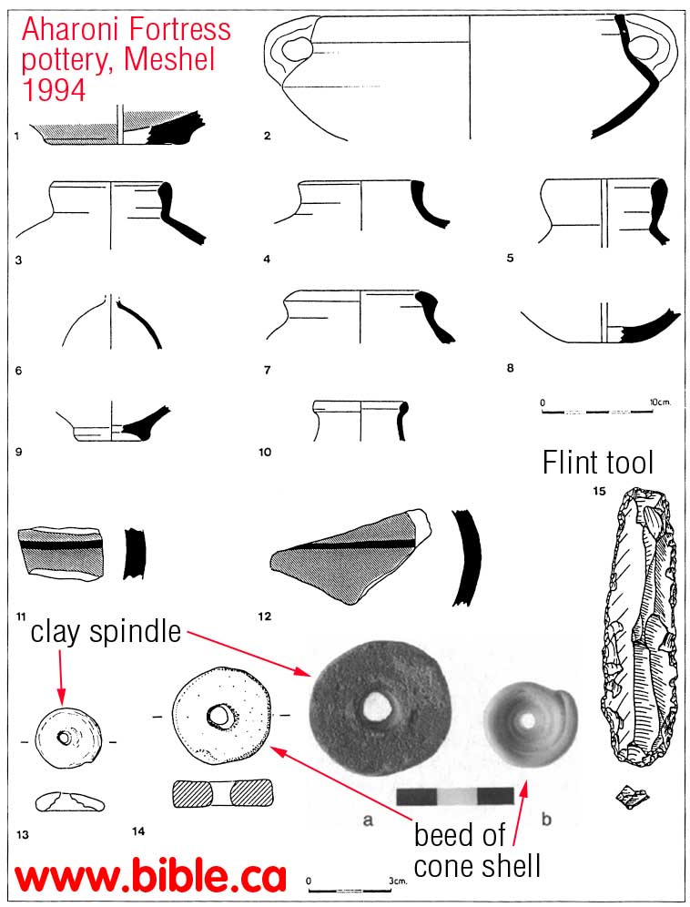
D. Negev pottery found at Quseima:
More on Negev Pottery.
The main finds, as stated, were potsherds. Not one complete or even restorable vessel was found. As usual in sites of this category in the Negev, the pottery was of two types: ordinary, wheel-made pottery, characteristic of the Iron Age; and rough, handmade pottery, of the type known as "Negev ware" (Cohen 1986). The number of Negev ware sherds was small. A selection of the ordinary vessels is shown in Figure 17. The pottery in general resembles that found in other fortress sites, as thoroughly demonstrated by Cohen (1986: 155-63). The bowl base, slipped on the outside and with band burnishing inside (figure 17:1), is similar to Cohen's figure 155.10. The cooking pot (figure 17:2) is a broad, low pot with carinated body; rounded base; two handles; and a broad, thickened lapped rim, either straight or slightly incurved. A few examples are illustrated(The "Aharoni Fortress" Near Quseima and the "Israelite Fortresses" in the Negev, Zeev Meshel, 1994 AD)
By Steve Rudd: Contact the author for comments, input or corrections.

Go To Start: WWW.BIBLE.CA